It is located near Matskivtsi village, Matskivtsi Village Council, Lubny district, Poltava region, 2.0 km to the north from the village, in Horodok (Horodyshche) and Podil natural landmark.
The fortified settlement is persuasively identified with the chronicle “town” of Sliporoda, which was mentioned for the 1st time in the stories about the campaign of Prince Gediminas against Kyiv in 1320-1321.
The examination surveys in Horodok natural landmark were conducted by V.H. Lyaskoronskyi in the end of 19th c. In 1945 the fortified settlement was examined by F. B. Kopylov and in 1948 – by I. I. Liapushkin. When surveying the defensive constructions, minor excavations were made by P. A. Rappoport in 1952.
In 1982-1989 the site was explored by Yu. Yu. Morgunov. He excavated 2.2 ths sq.m. at the square and 500 sq. m. at the uphill township within the complex.
Currently the archaeological complex of the chronicle town of Sniporid includes a fortified settlement, two townships, a burial mound and a ground burial site. The earlier layers are dated back to the end of the Neolithic Age – the Early Bronze Age (3rd – 2nd millennium BC). The high cape and its foot were inhabited in the late Scythian times as well (4th – 3rd cc. BC). The defence structures were built around the middle of 11th c., before that time there was an Old Russian township without fortifications. Around the middle of 13th c. the fortification was abandoned by its dwellers and since then active life was not renewed there. Separate findings of wheel-thrown dishes of 14th – 15th cc. indicate the existence of short-term settlement close to the foot and on the square of the fortified settlement.
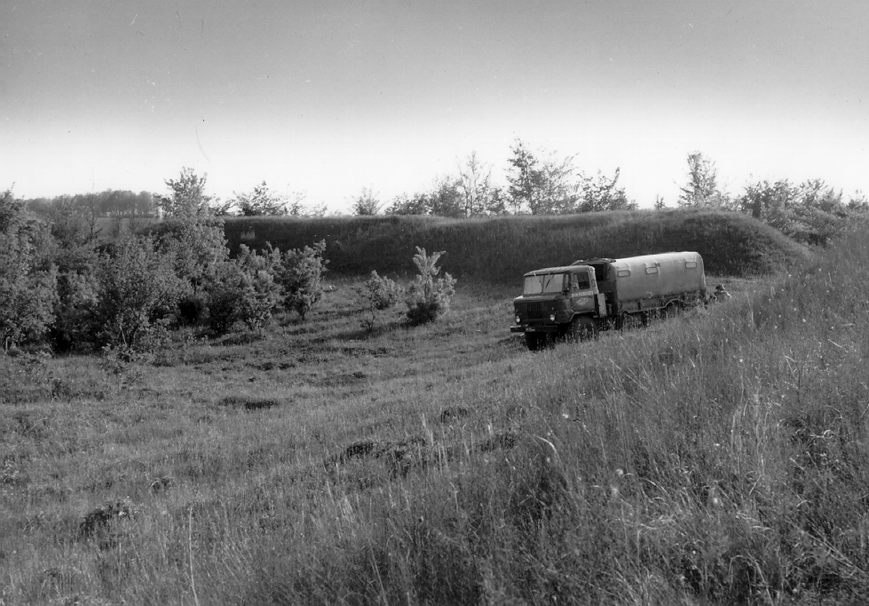
The fortified settlement square is covered with sward and partially with trees and bushes. The fortified settlement has a rounded and elongated shape (pear shape) on the plan, with the dimensions of 110 х 90 m. The square area is 0.9 ha. In the recent years the site has been ploughed. There is a hollow from an Old Russian well in its northern part with dimensions of 22 х 24 m and the depth of 3.0 m. Due to the excavations, now it is more than 4.0 m deep. The fortified settlement is protected by a circular on the plan breastwork, from 2 to 4 m high, and a ditch, approximately 10 m wide and 1m deep. The ancient entrance from the side facing the enemy was located in the west.
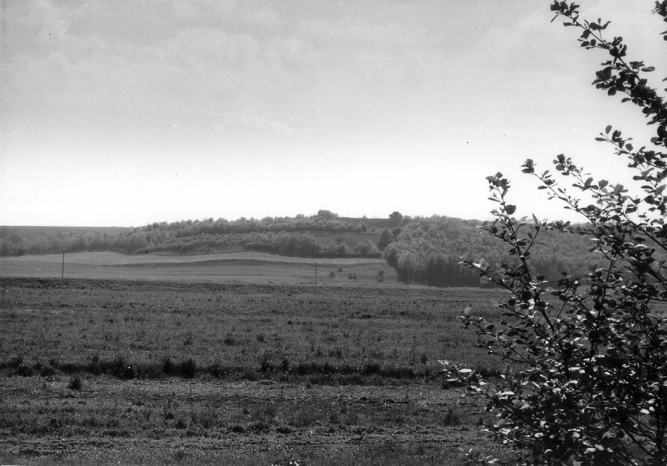
Uphill township occupies the plateau to the south and the east from the settlement fortifications. Downhill township is located to the east from fortifications. 1 km to the west from the fortifications the remains of a burial (?) mound has been discovered and to the south from the township there is a ground necropolis.
In 1985 a clay baking oven of the middle of 12th c. was discovered in the survey pit at uphill township. In the following year of 1986, approximately 20 middens, 1 structure and 3 dwellings were found in the started excavation pit.
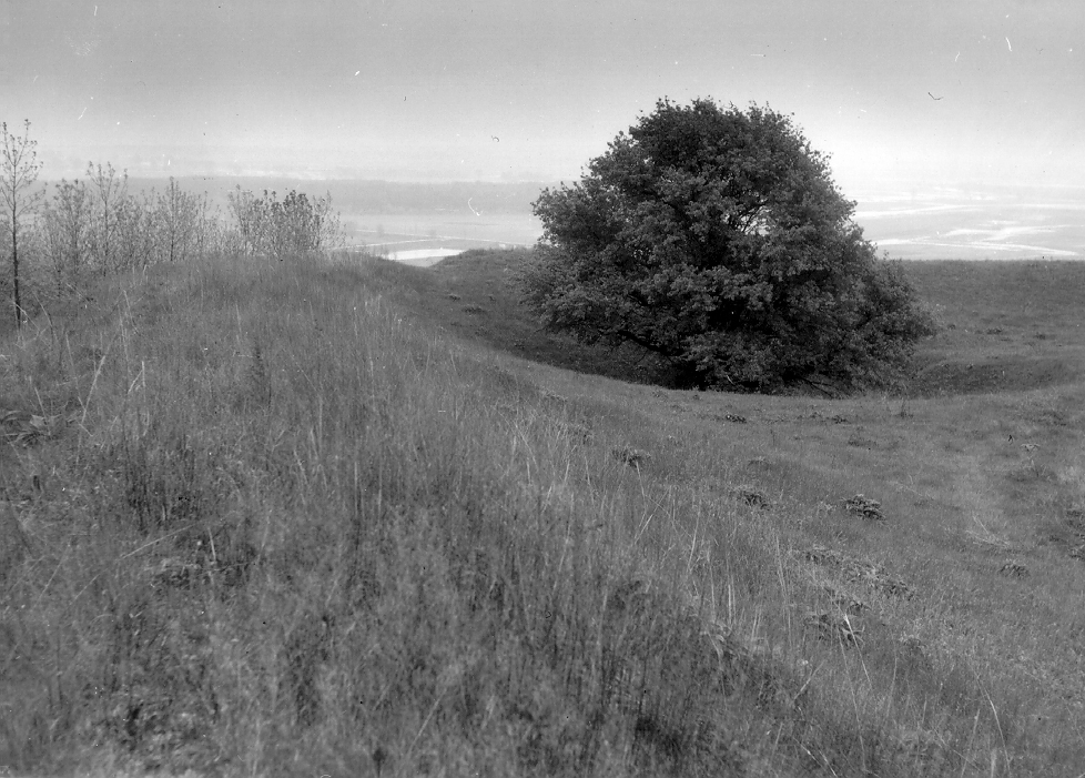
The remains of so-called “Zmiiovi Valy” (Snake Breastwork) are still preserved not far from the fortified settlement, to the north-east from it, in the wide pool of the Sliporid River. They can be followed to the distance of 5 km, between the fortified settlement, Terny village and Lysa Hora natural landmark, at the northern edge of Lubny town. The breastwork has the width of 9 m and the maximum height of 9 m in its best-preserved southern section. The breastwork was used to protect open townships and the Sliporid River pool mouth from the enemies’ attacks.
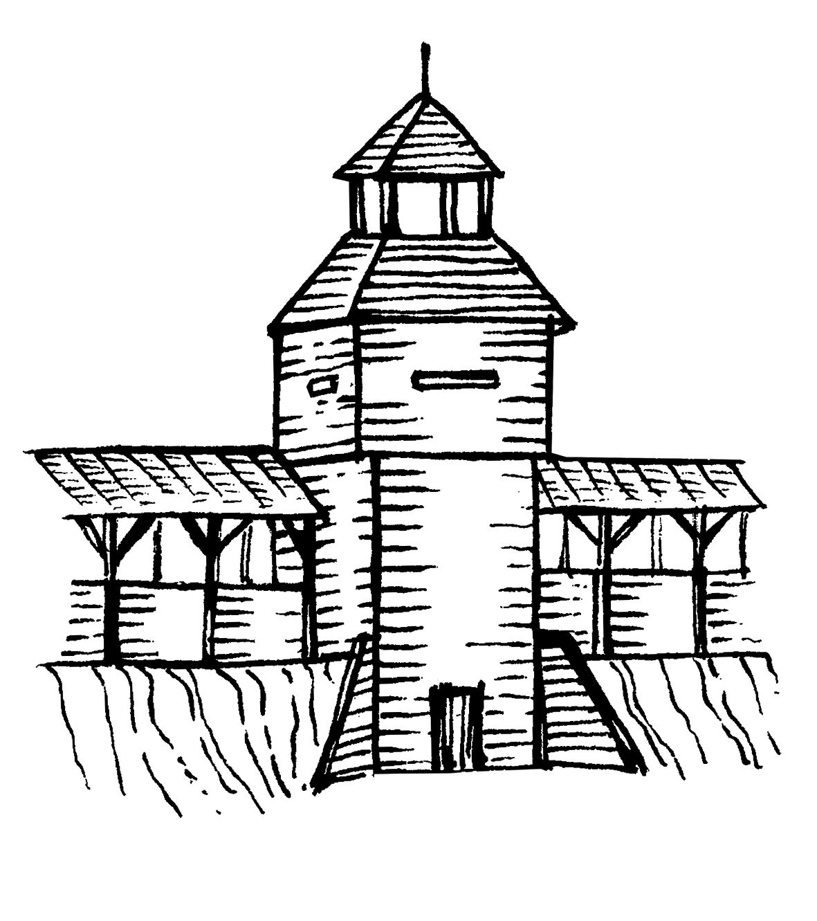
14 Old Russian burial sites – the remains of the ground necropolis of the end of 12th – 13th cc. were cleared in the central part of the square, which was undeveloped for some time. 7 clusters comprising 12 structures and several middens were discovered in the northern part of the fortification. An Old Russian well, which had been constructed even before the open township fortifications, was also surveyed. The fortification pear-like shape was determined by the wish to have the well on the protected territory. The entrance original structure also included a gate tower with suspension bridge. This section was archaeologically surveyed by O. V. Hryhoriev during his Posullia expedition.
The cultural layer 0.6-0.8 m thick was damaged by ploughing. It contains minor quantities of the Mesolithic Age, Late Neolithic Age, the Bronze Age, late Scythian times and the final stage of Romen culture materials, but the main massive was formed during the Old Russian times.
The fortified settlement of the chronicle town of Sniporid is one of the biggest preserved and surveyed fortified settlement of Old Russian Posullia defence line.
It has great historical and cultural value for the understanding of the peculiarities for appearance, development, decline and exploration of the fortified settlements of Old Russian Posullia defence line in 10th-14th cc. Numerous findings from the site reflect its population’s military orientation, which makes it an ideal place for surveying the fortified settlements of the similar functional purpose.
4th – 3rd millennium BC, 9th – 13th, 14th – 15th cc.
It is located near Matskivtsi village, Matskivtsi Village Council, Lubny district, Poltava region, 2.0 km to the north from the village, in Horodok (Horodyshche) and Podil natural landmark.
The fortified settlement is persuasively identified with the chronicle “town” of Sliporoda, which was mentioned for the 1st time in the stories about the campaign of Prince Gediminas against Kyiv in 1320-1321.
The examination surveys in Horodok natural landmark were conducted by V.H. Lyaskoronskyi in the end of 19th c. In 1945 the fortified settlement was examined by F. B. Kopylov and in 1948 – by I. I. Liapushkin. When surveying the defensive constructions, minor excavations were made by P. A. Rappoport in 1952.
In 1982-1989 the site was explored by Yu. Yu. Morgunov. He excavated 2.2 ths sq.m. at the square and 500 sq. m. at the uphill township within the complex.
Currently the archaeological complex of the chronicle town of Sniporid includes a fortified settlement, two townships, a burial mound and a ground burial site. The earlier layers are dated back to the end of the Neolithic Age – the Early Bronze Age (3rd – 2nd millennium BC). The high cape and its foot were inhabited in the late Scythian times as well (4th – 3rd cc. BC). The defence structures were built around the middle of 11th c., before that time there was an Old Russian township without fortifications. Around the middle of 13th c. the fortification was abandoned by its dwellers and since then active life was not renewed there. Separate findings of wheel-thrown dishes of 14th – 15th cc. indicate the existence of short-term settlement close to the foot and on the square of the fortified settlement.
The fortified settlement square is covered with sward and partially with trees and bushes. The fortified settlement has a rounded and elongated shape (pear shape) on the plan, with the dimensions of 110 х 90 m. The square area is 0.9 ha. In the recent years the site has been ploughed. There is a hollow from an Old Russian well in its northern part with dimensions of 22 х 24 m and the depth of 3.0 m. Due to the excavations, now it is more than 4.0 m deep. The fortified settlement is protected by a circular on the plan breastwork, from 2 to 4 m high, and a ditch, approximately 10 m wide and 1m deep. The ancient entrance from the side facing the enemy was located in the west.
Uphill township occupies the plateau to the south and the east from the settlement fortifications. Downhill township is located to the east from fortifications. 1 km to the west from the fortifications the remains of a burial (?) mound has been discovered and to the south from the township there is a ground necropolis.
In 1985 a clay baking oven of the middle of 12th c. was discovered in the survey pit at uphill township. In the following year of 1986, approximately 20 middens, 1 structure and 3 dwellings were found in the started excavation pit.
The remains of so-called “Zmiiovi Valy” (Snake Breastwork) are still preserved not far from the fortified settlement, to the north-east from it, in the wide pool of the Sliporid River. They can be followed to the distance of 5 km, between the fortified settlement, Terny village and Lysa Hora natural landmark, at the northern edge of Lubny town. The breastwork has the width of 9 m and the maximum height of 9 m in its best-preserved southern section. The breastwork was used to protect open townships and the Sliporid River pool mouth from the enemies’ attacks.
14 Old Russian burial sites – the remains of the ground necropolis of the end of 12th – 13th cc. were cleared in the central part of the square, which was undeveloped for some time. 7 clusters comprising 12 structures and several middens were discovered in the northern part of the fortification. An Old Russian well, which had been constructed even before the open township fortifications, was also surveyed. The fortification pear-like shape was determined by the wish to have the well on the protected territory. The entrance original structure also included a gate tower with suspension bridge. This section was archaeologically surveyed by O. V. Hryhoriev during his Posullia expedition.
The cultural layer 0.6-0.8 m thick was damaged by ploughing. It contains minor quantities of the Mesolithic Age, Late Neolithic Age, the Bronze Age, late Scythian times and the final stage of Romen culture materials, but the main massive was formed during the Old Russian times.
The fortified settlement of the chronicle town of Sniporid is one of the biggest preserved and surveyed fortified settlement of Old Russian Posullia defence line.
It has great historical and cultural value for the understanding of the peculiarities for appearance, development, decline and exploration of the fortified settlements of Old Russian Posullia defence line in 10th-14th cc. Numerous findings from the site reflect its population’s military orientation, which makes it an ideal place for surveying the fortified settlements of the similar functional purpose.
4th – 3rd millennium BC, 9th – 13th, 14th – 15th cc.
Read moreПам’яткоохоронна інформація
Monument protection information
Фотогалерея
Gallery
Мацківці, с. Городище літописного міста Сніпорода. Вигляд городища зі сходу. Фото 1982 р.
Мацківці, с. Городище літописного міста Сніпорода. Північно-східна частина городища. Колодязна яма. Фото 1982 р.
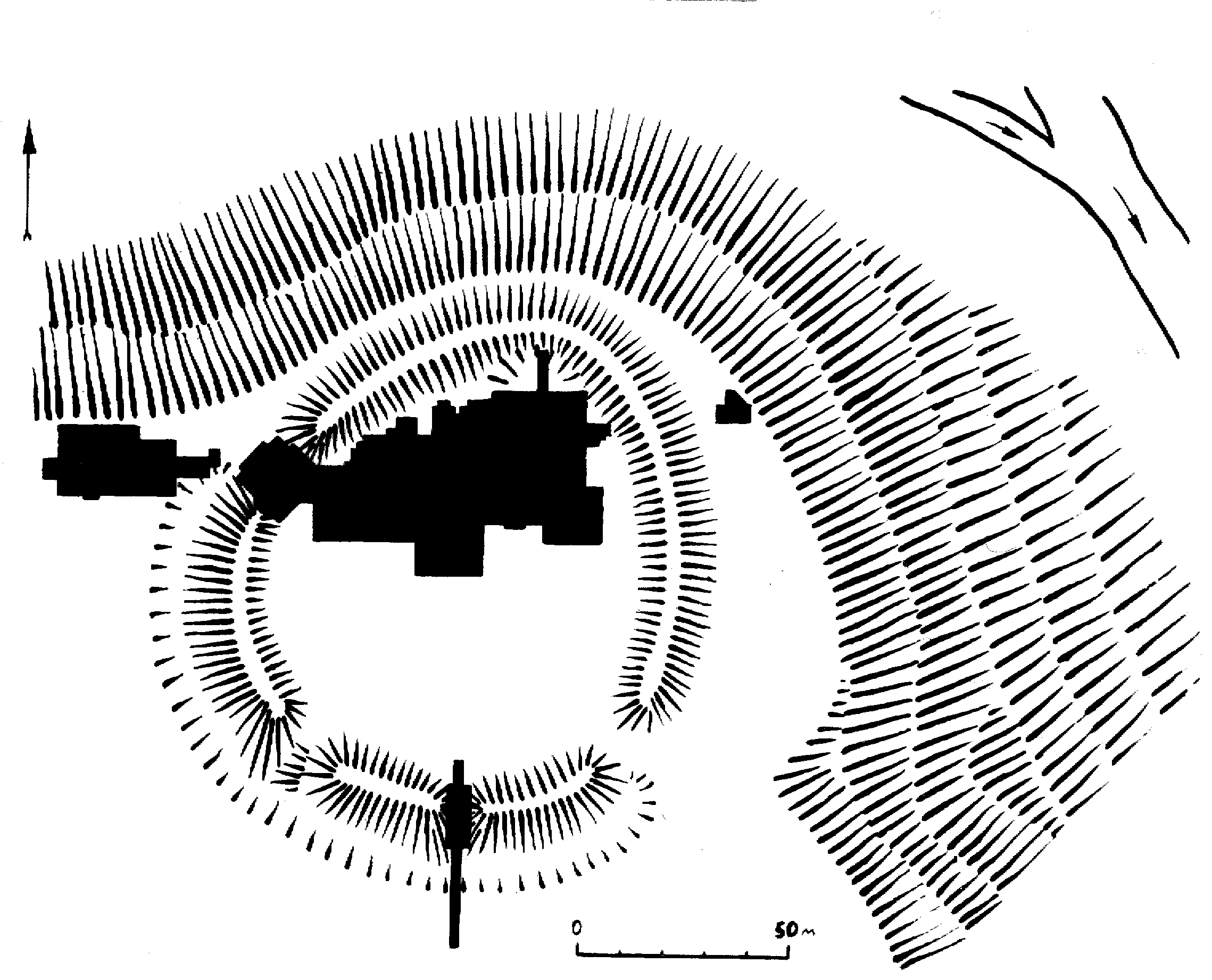
Мацківці, с. Городище літописного міста Сніпорода. Схема дослідженої території городища і посаду. Розкопки Моргунова Ю.Ю., 1982-1989 рр..