It is located around Bilsk village, Bilsk Village Council, Kotelva district, Poltava region.
In particular, Bilsk fortified settlement and its district sites are one of the most significant places among the archaeological sites of Ukraine and Poltava region. This is a unique archaeological complex, which is located on 7,521 hectares of the territory of Poltava region.
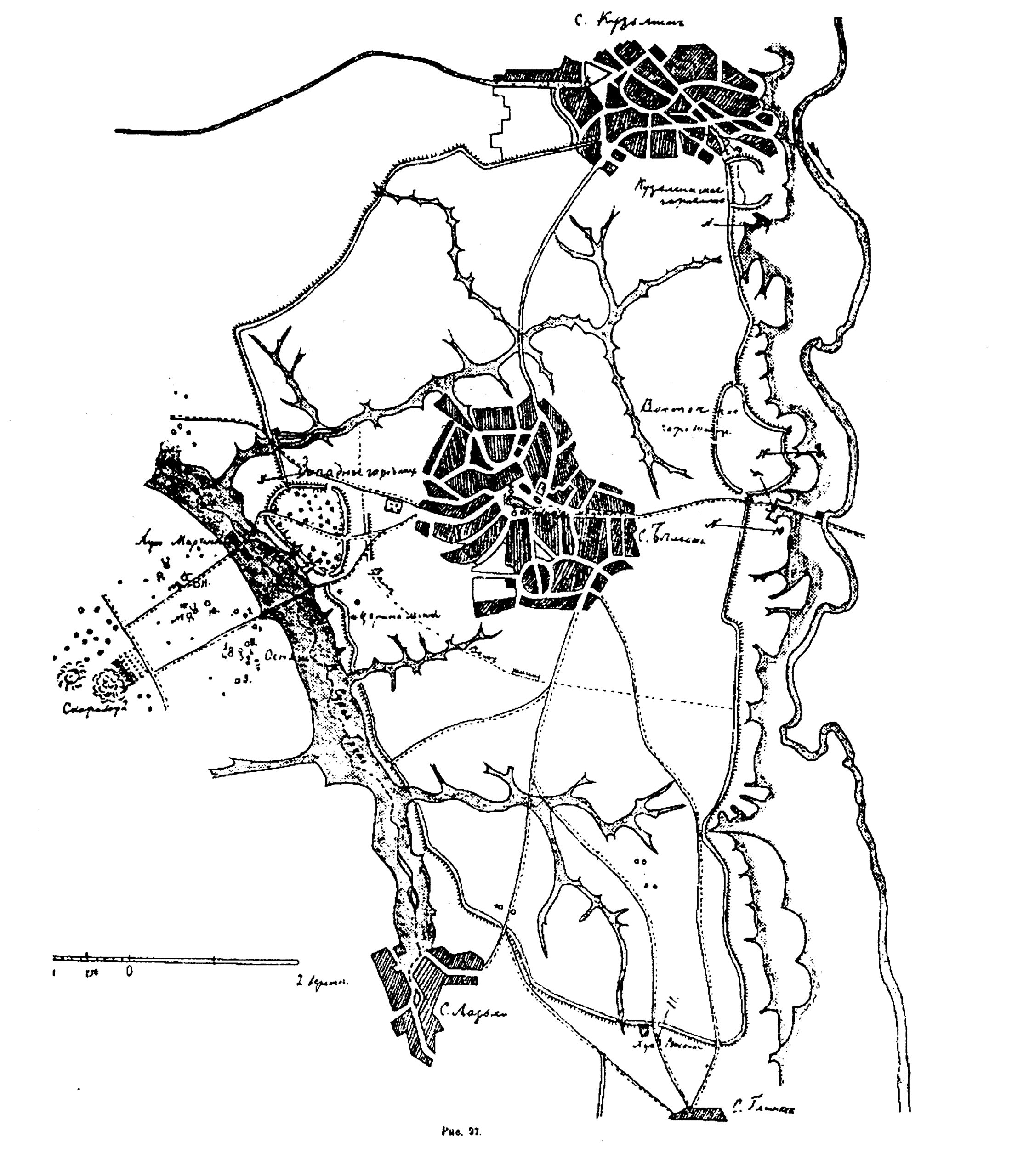
General features. The Bilsk archaeological complex is located on the inland plateau of the Vorskla and Sukha Hrun Rivers, mainly in Kotelva and Zinkiv districts, Poltava region. The northern part of the monumental site extends beyond Poltava region to Okhtyrka district of Sumy region. Most of the complex sites are located within the conditional quadrangle between Dovzhyk village (Kotelva district), Kuzemyn village (Okhtyrka district), Batky village and Hlynske village (Zinkiv district). Bilsk village of Kotelva district is located on the territory of Bilsk fortified settlement.
The Great Bilsk fortified settlement is the largest fortified settlement of the Early Iron Age in Europe. According to the latest estimates, its area is 4,875.2 hectares. It is a compound complex formed of the main parts: Western (95 ha), Eastern (85 ha) and Kuzemynske fortifications (15.4 ha), which are included in the single system of the Great Bilsk fortification (4,687.8 ha). To understand the size of this huge settlement, which existed more than 2,500 years ago, it is enough to recall that its contemporary between the Tigris and Euphrates Rivers – one of the first towns in human history Babylon – in its heyday (7th – 6th cc. BC) occupied a rectangle area of about 1,000 hectares, i.e. it was almost five times smaller.
Other features are also revealing. Thus, the length of Bilsk fortified settlement from north to south is 11,660 m, from west to east – 6,520 m. Such a large size of the ancient settlement can be compared with the scale of some modern cities of Ukraine. In particular, such areas as Lutsk, Ivano-Frankivsk, Rivne or Uzhhorod could be located with excess on the territory of the fortified settlement.
Scientific research findings. For the first time, kurgans and fortified settlements in Bilsk area are mentioned in manuscripts and documents of the early 17th c. on the development of nitrate deposit on the embankments of the huge Skorobor kurgan by Polish industrials. A detailed description of the complex of sites was given by count O.O. Bobrynskyi. He made the first archaeological excavations in the district, exploring in 1897 the kurgan destroyed by treasure hunters near Hlynyshche village. He first determined the belonging of sites to the Scythian era, gave a description of the Western and part of the fortifications of the Great Bilsk fortified settlement.
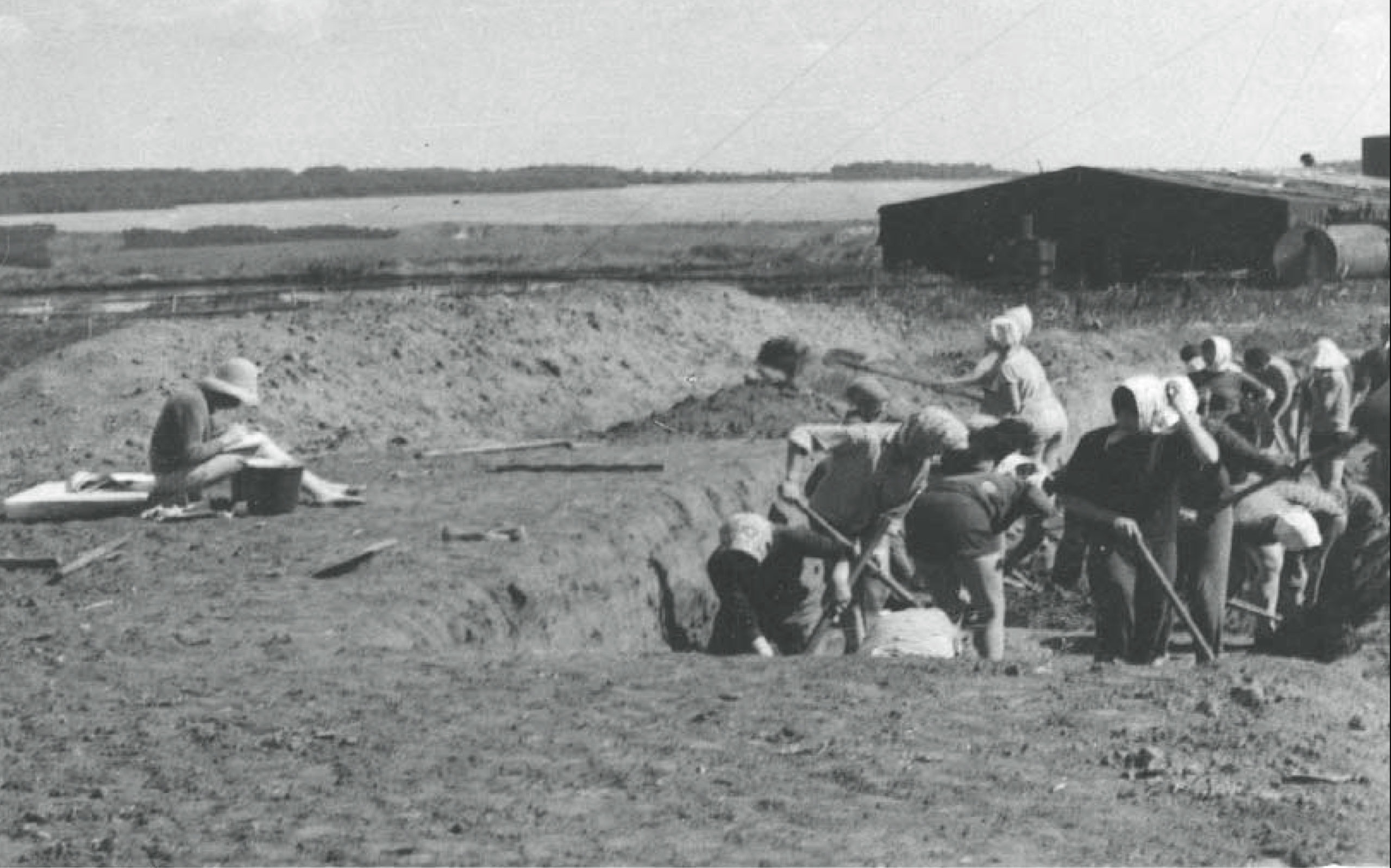
At the beginning of the 20th c. several detailed descriptions of individual sites of the complex appeared, which were made by V.H. Liaskoronskyi and L.V. Padalka. The first large-scale research at Bilsk fortified settlement was carried out by V.O. Horodtsov. During one field season in 1906, scientists studied areas of cultural layers on the Western fortified settlement and within the Great Fortress, 22 kurgans and squares, and works were carried out in the settlements around the fortified settlement.
In 1954, the Scythian-Slavic expedition of Kharkiv University led by B.A. Shramko started works on the fortified settlement. In 1958-1960, a group of scientists from Moscow University led by Professor B.M. Grakov took part in it, and later the research group consisted of separate teams of specialists from different cities of Ukraine – A.O. Moruzhenko, V.P. Andrienko (Donetsk), Yu.M. Boiko (Vinnytsia), P.Ya. Havrysh (Poltava), I.B. Shramko (Kharkiv) and others.
Since 1992, necropolises and sites of the wide district of Bilsk fortified settlement studied by the Ukrainian-German expedition of the Institute of Archaeology of the National Academy of Sciences of Ukraine and Hamburg University led by V.Yu. Murzina, Ye.V. Chernenka and R. Rolle honorary academician of the Institute of Archaeology of the National Academy of Sciences of Ukraine. Since 1989, a group of Kharkiv researcher I.B. Shramko has been excavating ashtrays in the Western Fortress. Since 1994, the research has been conducted here by an expedition of the Poltava Regional Centre for Preservation and Investigation of Archaeological Sites led by O.B. Suprunenko. A practical expedition of Poltava State Pedagogical University (P.Ya. Havrysh) worked here for some time.
With the establishment of the Municipal Institution “Bilsk Historical and Cultural Heritage Site”, its employees actively began to study Bilsk fortified settlement and its area. The territories of the northern part of Bilsk fortified settlement (O.V. Korotia, E.V. Osadchyi), the southern part (V.V. Priimak, I.I. Korost, O.M. Shapord) were studied, excavations of kurgans of Skorobir natural landmarks were carried out (with the participation of I.B. Shramko). Interesting Archaeological School for Young Archaeologists (headed by D.S. Hrechko) were held on the territory of Bilsk fortified settlement, which has been going on for several years in a row during the summer season.
Some study findings. As a result of field researches, it was discovered that the oldest cultural layers on the territory of the Great Bilsk fortified settlement belong to the Timber-grave and Bondarikhin cultures of the Bronze Age, when there were widespread small open settlements. In the 8th and the beginning of the 7th centuries BC, with the formation of the Vorsklin local version of the Early Iron Age forest-steppe culture, new settlements appeared within the site area. And in the 7th – 6th centuries BC, two primary fortifications were built almost simultaneously — Western (slightly earlier) on the right bank of the Sukha Hrun river and Eastern (later) on the right bank of the Vorskla river, which were soon united by fortifications of the Great Fortress of Bilsk. Later, the Kuzemin Fortress was included in this complex in the 5th century BC.
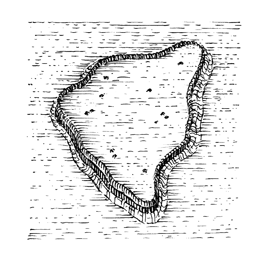
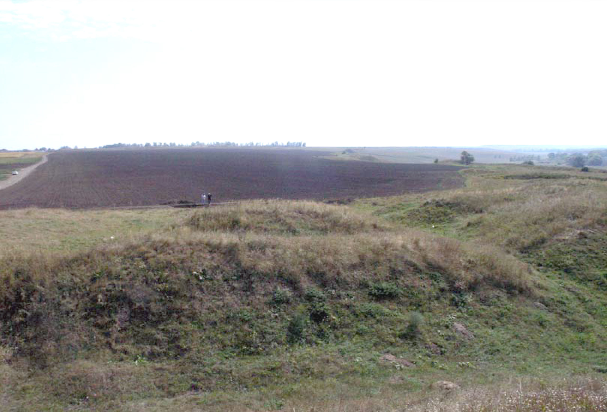
All these parts of Bilsk fortified settlement were protected by powerful wooden and earthen fortifications, which consisted of deep moats and high breastworks, topped by wooden walls with towers. According to the calculations of B.A. Shramko, the total length of the breastworks of the Western fortification was 3,270 m, the Eastern – 3,870 m, the preserved Kuzemin – 898 m, the Great Bilsk fortification – 25,995 m; the total length of all fortifications exceeds 36,000 m.
The grand fortress securely protected the inhabitants from enemy attacks. Some areas of the fortifications still have traces of attacks, although the enemy probably never managed to completely storm the fortress. There are well-founded assumptions that the famous Persian king Darius sent part of his army to the capital of the Scythian allies – the Gelons in the Greco-Persian war of the 5th century BC. The damaged parts of the breastworks and walls were not only repaired, but also strengthened after the attacks. Archaeologists have identified five major renovations and many local repairs. Given the scale of the fortifications, such an ambitious activity was possible only for the then huge number of participants – 30-50 thousand people, gathered from different parts of the territory for several seasons.
On various grounds, the population of Bilsk fortified settlement was ethnically heterogeneous. Here huts, immigrants from the modern Ukrainian south-east or south territories lived – Gelons, Nevrs and, probably, representatives of other ethnic groups.
Bilsk fortified settlement was a significant political and cultural centre of Scythian times. Probably, the territory ruled by the proto-city “Chora” covered the basins of the Middle and Lower Vorskla River, Psel River, the interfluve of these rivers, and, possibly, the regional Sula river system. During the excavations, the remains of semi-dugout and ground dwellings, various household buildings (cellars, pits, granaries, dryers, etc.), the remains of workshops (blacksmiths, bronze foundries, jewellers, potters, bone cutters, etc.) were found. Certain planning principles of placement of estates on the Eastern fortification, presence of two-storeyed wooden constructions is noted. There are the remains of altars and temples, in one of which probably astronomical observations were made. Numerous findings of ceramic sculptures (anthropo-, zoo- and ornithomorphic statuettes, other votive items) confirm the existence of agricultural fertility cults among the local population. The celebrations of Dionysus, mentioned by Herodotus, were held in the fortified settlement.
The population of Bilsk fortified settlement existed due to agriculture, gardening, cattle breeding, hunting, various crafts and handicrafts, trade. The trade links of the city centre were intensive and large-scale. The favourable geographical position of the fortified settlement allowed the use of an extensive system of river and land routes. The findings of imported products and especially antique painted utensils, amphorae, glassware indicate connections with many centres of the ancient world (Ionia, Attica, Samos, Rhodes, Chios, Lesbos, Fasos, Kos, Sinop, Heraclea, Navkratis, etc.).
During its historical development, Bilsk fortified settlement from the tribe union centre turned into a city centre, which is identified by a number of researchers (V.M. Shcherbakovskyi, B.A. Shramko, B.O. Rybakov) with the Herodotus mentioned city of Gelon. The basis of its heyday were crafts and trade. This continued until the beginning of the 3rd c. BC, when important political and economic changes took place in the south of Eastern Europe, caused by climatic and other factors that disrupted the ties of Bilsk fortified settlement and led to the decline of local crafts and trade, reducing the yield of agricultural land. Life on the fortified settlement was gradually fading and it ended its existence as a significant centre.
Small settlements existed at a later time on the territory of Bilsk fortified settlement. Remains of settlements of the late Zarubintsy (Ozero natural landmark), Kyiv (Sad natural landmark), Cherniakhiv (Marchenko natural landmark, Pereshchepyne, Sad, Center, Eastern fortifications), Penkova cultures, location of items of Salt and Romen cultures, isolated Pecheneg antiquities were found. There are traces of settlement of the Kievan-Rus era on the Eastern fortification of the fortified settlement. A unique ancient fibula with inscription in Greek alphabet letters was found on the Eastern fortification of Bilsk fortified settlement. There were Romen and Old Russian fortified settlements in the 8th – 13th cc. to the south and north of Hlynsk and Kuzemin fortified settlement.
District sites. The mound necropoli of Bilsk fortified settlement are located to the west and north-west of the Great Fortress. These are burial mound in Skorobir, Osniahy, Marchenko, Sarancheve Pole and Pereshchepyne natural landmarks. At the beginning of the 20th century, there were more than 1,000 mounds of various heights, ranging from 0.5 to 3-4 m. Today, according to incomplete mapping data, this number does not exceed 600 still preserved banks. There are also two separate burial mounds on the territory of Bilsk fortified settlement connected with the vital activity of townships on the territory of the Great Fortress – A and B burial mounds.
Nature sites. There are many natural objects on the territory of the complex, where the flora and landscape are protected. These sites include Skovoroda oak, a group of steppe vegetation on Skorobor and Rozryta Mohyla, and the breastworks of the Great Fortress of Bilsk fortified settlement. The Bilsk spring near Barvinkova hill has been widely known since the 17th century. The eastern area of the fortified settlement borders on a natural site of national significance – Kovpakivskyi dendrological park.
2nd millennium – 4th c. BC, 2nd – 5th, 5th – 7th, 17th – 18th cc.
It is located around Bilsk village, Bilsk Village Council, Kotelva district, Poltava region.
In particular, Bilsk fortified settlement and its district sites are one of the most significant places among the archaeological sites of Ukraine and Poltava region. This is a unique archaeological complex, which is located on 7,521 hectares of the territory of Poltava region.
General features. The Bilsk archaeological complex is located on the inland plateau of the Vorskla and Sukha Hrun Rivers, mainly in Kotelva and Zinkiv districts, Poltava region. The northern part of the monumental site extends beyond Poltava region to Okhtyrka district of Sumy region. Most of the complex sites are located within the conditional quadrangle between Dovzhyk village (Kotelva district), Kuzemyn village (Okhtyrka district), Batky village and Hlynske village (Zinkiv district). Bilsk village of Kotelva district is located on the territory of Bilsk fortified settlement.
The Great Bilsk fortified settlement is the largest fortified settlement of the Early Iron Age in Europe. According to the latest estimates, its area is 4,875.2 hectares. It is a compound complex formed of the main parts: Western (95 ha), Eastern (85 ha) and Kuzemynske fortifications (15.4 ha), which are included in the single system of the Great Bilsk fortification (4,687.8 ha). To understand the size of this huge settlement, which existed more than 2,500 years ago, it is enough to recall that its contemporary between the Tigris and Euphrates Rivers – one of the first towns in human history Babylon – in its heyday (7th – 6th cc. BC) occupied a rectangle area of about 1,000 hectares, i.e. it was almost five times smaller.
Other features are also revealing. Thus, the length of Bilsk fortified settlement from north to south is 11,660 m, from west to east – 6,520 m. Such a large size of the ancient settlement can be compared with the scale of some modern cities of Ukraine. In particular, such areas as Lutsk, Ivano-Frankivsk, Rivne or Uzhhorod could be located with excess on the territory of the fortified settlement.
Scientific research findings. For the first time, kurgans and fortified settlements in Bilsk area are mentioned in manuscripts and documents of the early 17th c. on the development of nitrate deposit on the embankments of the huge Skorobor kurgan by Polish industrials. A detailed description of the complex of sites was given by count O.O. Bobrynskyi. He made the first archaeological excavations in the district, exploring in 1897 the kurgan destroyed by treasure hunters near Hlynyshche village. He first determined the belonging of sites to the Scythian era, gave a description of the Western and part of the fortifications of the Great Bilsk fortified settlement.
At the beginning of the 20th c. several detailed descriptions of individual sites of the complex appeared, which were made by V.H. Liaskoronskyi and L.V. Padalka. The first large-scale research at Bilsk fortified settlement was carried out by V.O. Horodtsov. During one field season in 1906, scientists studied areas of cultural layers on the Western fortified settlement and within the Great Fortress, 22 kurgans and squares, and works were carried out in the settlements around the fortified settlement.
In 1954, the Scythian-Slavic expedition of Kharkiv University led by B.A. Shramko started works on the fortified settlement. In 1958-1960, a group of scientists from Moscow University led by Professor B.M. Grakov took part in it, and later the research group consisted of separate teams of specialists from different cities of Ukraine – A.O. Moruzhenko, V.P. Andrienko (Donetsk), Yu.M. Boiko (Vinnytsia), P.Ya. Havrysh (Poltava), I.B. Shramko (Kharkiv) and others.
Since 1992, necropolises and sites of the wide district of Bilsk fortified settlement studied by the Ukrainian-German expedition of the Institute of Archaeology of the National Academy of Sciences of Ukraine and Hamburg University led by V.Yu. Murzina, Ye.V. Chernenka and R. Rolle honorary academician of the Institute of Archaeology of the National Academy of Sciences of Ukraine. Since 1989, a group of Kharkiv researcher I.B. Shramko has been excavating ashtrays in the Western Fortress. Since 1994, the research has been conducted here by an expedition of the Poltava Regional Centre for Preservation and Investigation of Archaeological Sites led by O.B. Suprunenko. A practical expedition of Poltava State Pedagogical University (P.Ya. Havrysh) worked here for some time.
With the establishment of the Municipal Institution “Bilsk Historical and Cultural Heritage Site”, its employees actively began to study Bilsk fortified settlement and its area. The territories of the northern part of Bilsk fortified settlement (O.V. Korotia, E.V. Osadchyi), the southern part (V.V. Priimak, I.I. Korost, O.M. Shapord) were studied, excavations of kurgans of Skorobir natural landmarks were carried out (with the participation of I.B. Shramko). Interesting Archaeological School for Young Archaeologists (headed by D.S. Hrechko) were held on the territory of Bilsk fortified settlement, which has been going on for several years in a row during the summer season.
Some study findings. As a result of field researches, it was discovered that the oldest cultural layers on the territory of the Great Bilsk fortified settlement belong to the Timber-grave and Bondarikhin cultures of the Bronze Age, when there were widespread small open settlements. In the 8th and the beginning of the 7th centuries BC, with the formation of the Vorsklin local version of the Early Iron Age forest-steppe culture, new settlements appeared within the site area. And in the 7th – 6th centuries BC, two primary fortifications were built almost simultaneously — Western (slightly earlier) on the right bank of the Sukha Hrun river and Eastern (later) on the right bank of the Vorskla river, which were soon united by fortifications of the Great Fortress of Bilsk. Later, the Kuzemin Fortress was included in this complex in the 5th century BC.
All these parts of Bilsk fortified settlement were protected by powerful wooden and earthen fortifications, which consisted of deep moats and high breastworks, topped by wooden walls with towers. According to the calculations of B.A. Shramko, the total length of the breastworks of the Western fortification was 3,270 m, the Eastern – 3,870 m, the preserved Kuzemin – 898 m, the Great Bilsk fortification – 25,995 m; the total length of all fortifications exceeds 36,000 m.
The grand fortress securely protected the inhabitants from enemy attacks. Some areas of the fortifications still have traces of attacks, although the enemy probably never managed to completely storm the fortress. There are well-founded assumptions that the famous Persian king Darius sent part of his army to the capital of the Scythian allies – the Gelons in the Greco-Persian war of the 5th century BC. The damaged parts of the breastworks and walls were not only repaired, but also strengthened after the attacks. Archaeologists have identified five major renovations and many local repairs. Given the scale of the fortifications, such an ambitious activity was possible only for the then huge number of participants – 30-50 thousand people, gathered from different parts of the territory for several seasons.
On various grounds, the population of Bilsk fortified settlement was ethnically heterogeneous. Here huts, immigrants from the modern Ukrainian south-east or south territories lived – Gelons, Nevrs and, probably, representatives of other ethnic groups.
Bilsk fortified settlement was a significant political and cultural centre of Scythian times. Probably, the territory ruled by the proto-city “Chora” covered the basins of the Middle and Lower Vorskla River, Psel River, the interfluve of these rivers, and, possibly, the regional Sula river system. During the excavations, the remains of semi-dugout and ground dwellings, various household buildings (cellars, pits, granaries, dryers, etc.), the remains of workshops (blacksmiths, bronze foundries, jewellers, potters, bone cutters, etc.) were found. Certain planning principles of placement of estates on the Eastern fortification, presence of two-storeyed wooden constructions is noted. There are the remains of altars and temples, in one of which probably astronomical observations were made. Numerous findings of ceramic sculptures (anthropo-, zoo- and ornithomorphic statuettes, other votive items) confirm the existence of agricultural fertility cults among the local population. The celebrations of Dionysus, mentioned by Herodotus, were held in the fortified settlement.
The population of Bilsk fortified settlement existed due to agriculture, gardening, cattle breeding, hunting, various crafts and handicrafts, trade. The trade links of the city centre were intensive and large-scale. The favourable geographical position of the fortified settlement allowed the use of an extensive system of river and land routes. The findings of imported products and especially antique painted utensils, amphorae, glassware indicate connections with many centres of the ancient world (Ionia, Attica, Samos, Rhodes, Chios, Lesbos, Fasos, Kos, Sinop, Heraclea, Navkratis, etc.).
During its historical development, Bilsk fortified settlement from the tribe union centre turned into a city centre, which is identified by a number of researchers (V.M. Shcherbakovskyi, B.A. Shramko, B.O. Rybakov) with the Herodotus mentioned city of Gelon. The basis of its heyday were crafts and trade. This continued until the beginning of the 3rd c. BC, when important political and economic changes took place in the south of Eastern Europe, caused by climatic and other factors that disrupted the ties of Bilsk fortified settlement and led to the decline of local crafts and trade, reducing the yield of agricultural land. Life on the fortified settlement was gradually fading and it ended its existence as a significant centre.
Small settlements existed at a later time on the territory of Bilsk fortified settlement. Remains of settlements of the late Zarubintsy (Ozero natural landmark), Kyiv (Sad natural landmark), Cherniakhiv (Marchenko natural landmark, Pereshchepyne, Sad, Center, Eastern fortifications), Penkova cultures, location of items of Salt and Romen cultures, isolated Pecheneg antiquities were found. There are traces of settlement of the Kievan-Rus era on the Eastern fortification of the fortified settlement. A unique ancient fibula with inscription in Greek alphabet letters was found on the Eastern fortification of Bilsk fortified settlement. There were Romen and Old Russian fortified settlements in the 8th – 13th cc. to the south and north of Hlynsk and Kuzemin fortified settlement.
District sites. The mound necropoli of Bilsk fortified settlement are located to the west and north-west of the Great Fortress. These are burial mound in Skorobir, Osniahy, Marchenko, Sarancheve Pole and Pereshchepyne natural landmarks. At the beginning of the 20th century, there were more than 1,000 mounds of various heights, ranging from 0.5 to 3-4 m. Today, according to incomplete mapping data, this number does not exceed 600 still preserved banks. There are also two separate burial mounds on the territory of Bilsk fortified settlement connected with the vital activity of townships on the territory of the Great Fortress – A and B burial mounds.
Nature sites. There are many natural objects on the territory of the complex, where the flora and landscape are protected. These sites include Skovoroda oak, a group of steppe vegetation on Skorobor and Rozryta Mohyla, and the breastworks of the Great Fortress of Bilsk fortified settlement. The Bilsk spring near Barvinkova hill has been widely known since the 17th century. The eastern area of the fortified settlement borders on a natural site of national significance – Kovpakivskyi dendrological park.
2nd millennium – 4th c. BC, 2nd – 5th, 5th – 7th, 17th – 18th cc.
Read moreПам’яткоохоронна інформація
Monument protection information
Пам’ятка археології національного значення.
Постанова Кабінету Міністрів України від 03.09.2009 № 928.
охоронний номер 160018-Н.
Більськ_Західне городтще_Котелевський_обл_картка
bilsk_zahidne-gorodtshhe_kotelevskyj_pasport.pdfПам’ятка археології національного значення.
Постанова Кабінету Міністрів України від 03.09.2009 № 928.
охоронний номер 160018-Н.
Більськ_Західне городтще_Котелевський_обл_картка
bilsk_zahidne-gorodtshhe_kotelevskyj_pasport.pdfФотогалерея
Gallery

Більськ, с. Більське городище. Західне укріплення. Вигляд згори.
Більськ, с. Більське городище. Вали Західного укріплення пошкодженні селітроварним виробництвом.
Більськ, с. Більське городище. План за В.О. Городцовим, 1906 р.
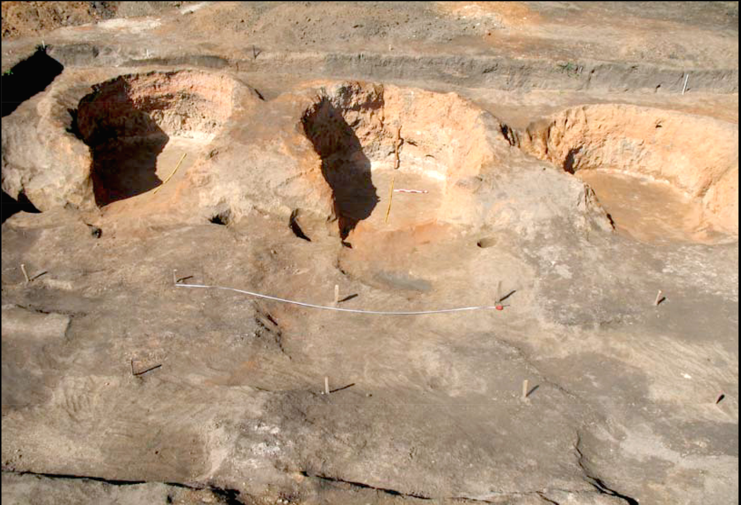
Більськ, с. Більське городище. Археологічні дослідження на Західному укріпленні, кер. І.Б. Шрамко.
Більськ, с. Більське городище. Рештки печей.
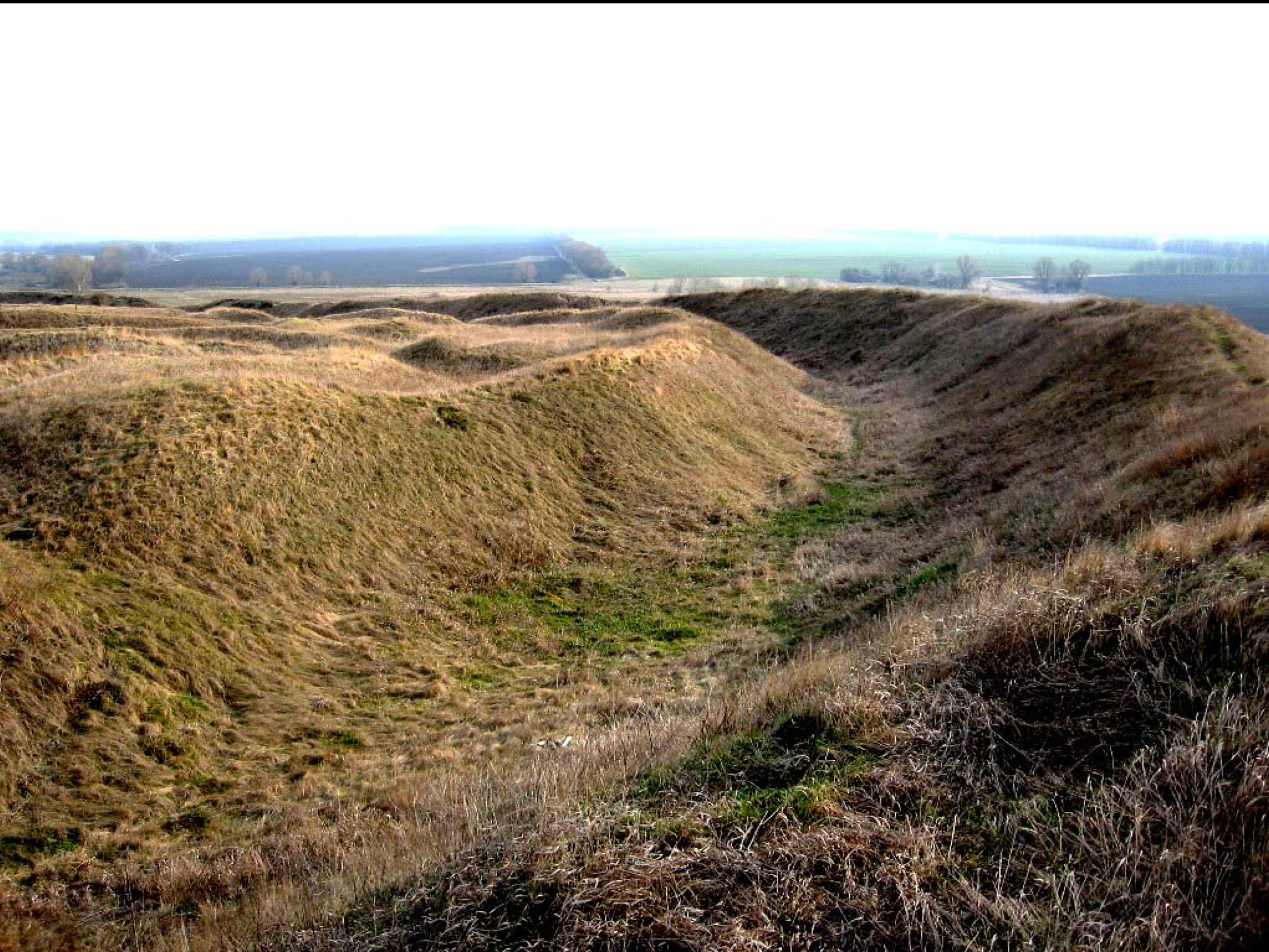
Більськ, с. Більське городище. Вали укріплення.
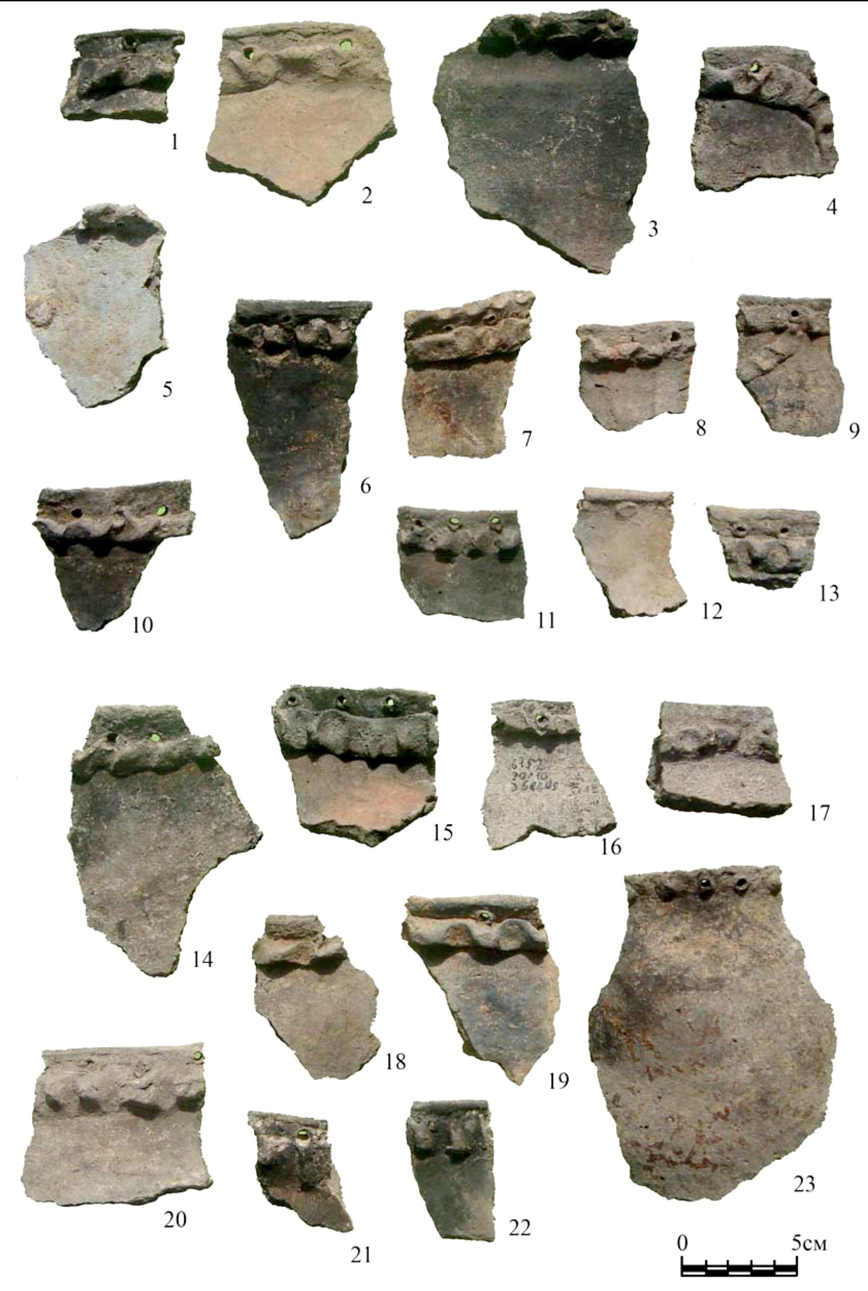
Більськ, с. Більське городище. Уламки ліпного глиняного посуду. Скіфський час.
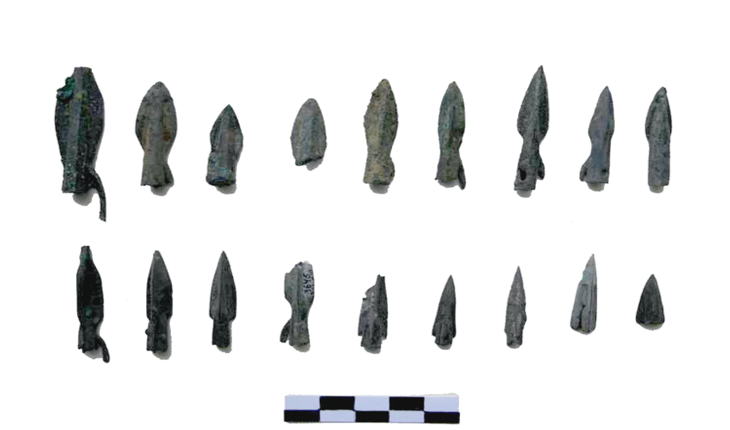
Більськ, с. Більське городище. Наконечники стріл. Скіфський час.
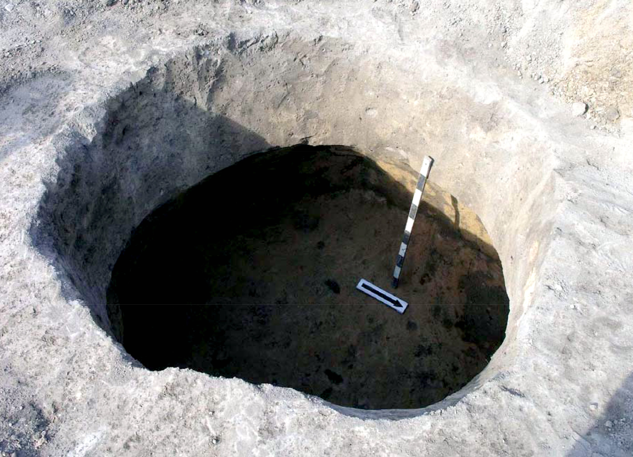
Більськ, с. Більське городище. Господарська яма.
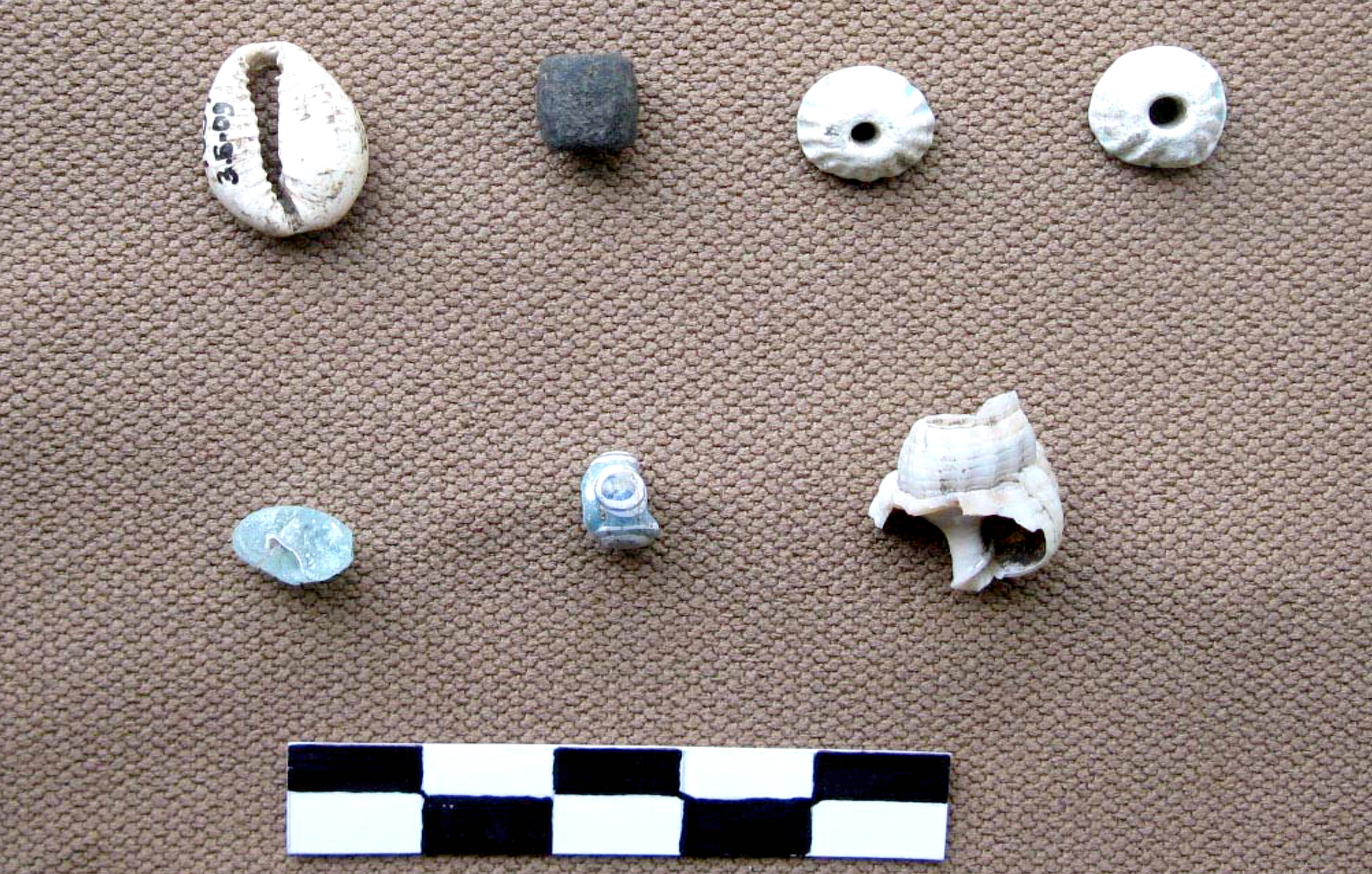
Більськ, с. Більське городище. Знахідки прикрас, так звані ракушки "каурі". Скіфський час.
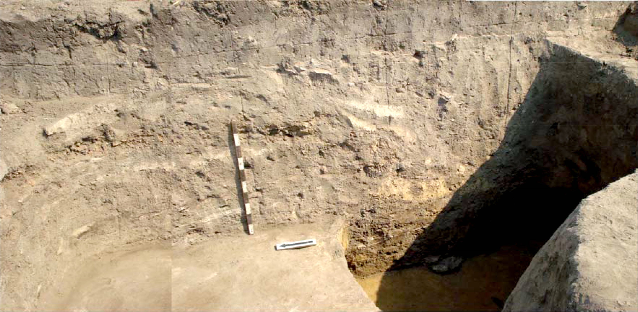
Більськ, с. Більське городище. Археологічні дослідження.