
It is located in the north-western part of Kotelva Village Council, Kotelva district, Poltava region, 8.49 km to the north-southwest of the Kotelva Village Council building, 2.9 km to the south-southwest of the edge of Ukrainka village, Okhtyrka district, Sumy region, in forest massif of SE “Kotelevske forestry”, in Horodyshche natural landmark, near Zinkivshchyna natural landmark.
Kotelevske fortified settlement is known according to the testimony of Archbishop Filaret’s informants from the middle of the 19th c., the report of the local historian O.V. Tverdokhlebov in 1888. It was first surveyed in detail by O.B. Suprunenko in 2000, examined by V.V. Priimak in 2007 and together in 2014.
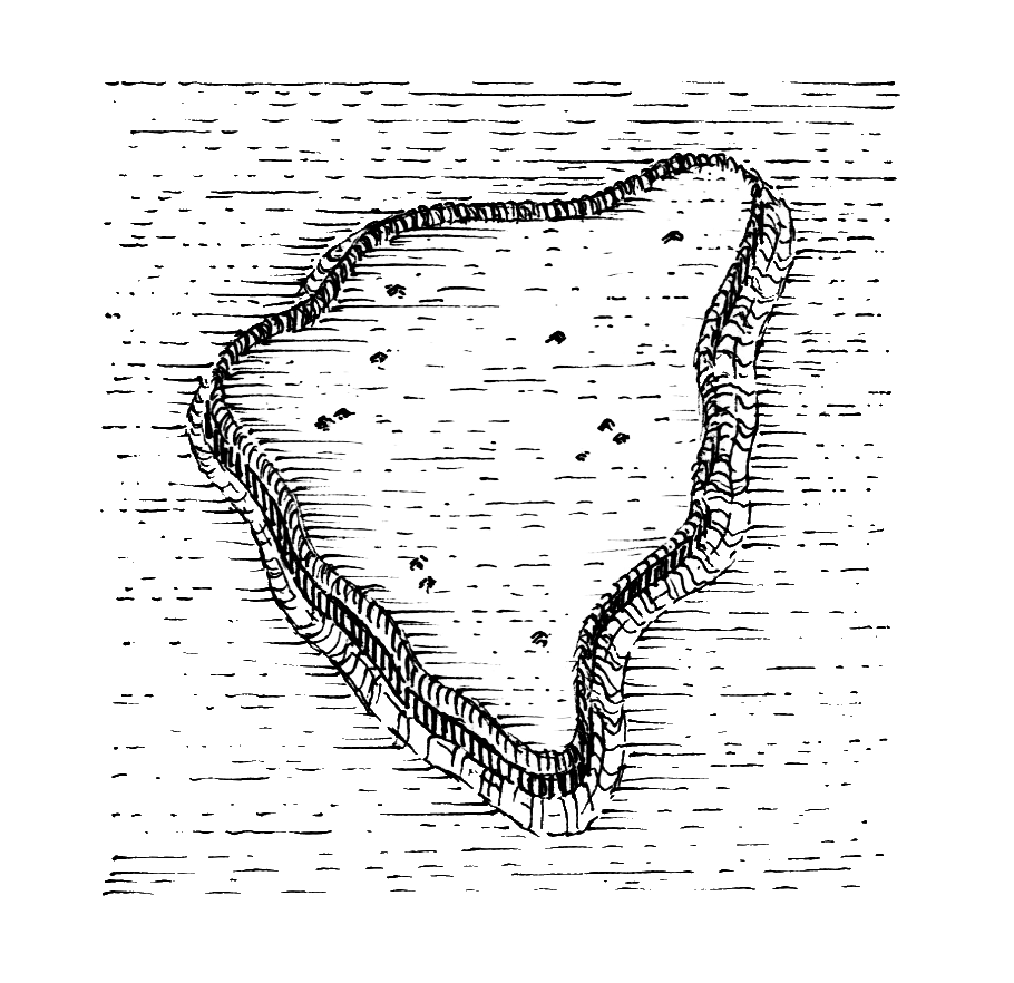
The fortified settlement is located on the sandy remains of the second terrace of the left bank of the Vorskla River and has a subtriangular shape.
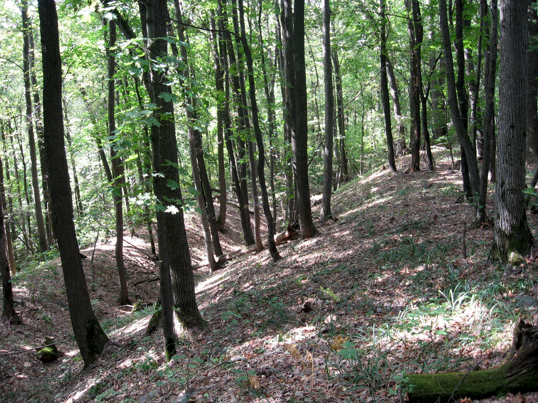
The site area is 3.3 hectares. It is surrounded by breastworks 3-5 m at the base and 1.2 to 4.0 m height. The lowest south-western part of the fortifications in the whole fortified settlement is reinforced by a kurgan-like bank, its diameter is 14 m, and height is 2.6 m. The uphill can be considered as the basis of a tower-like fortification at one of the entrances.
In the course of research a small but clear collection of findings was obtained. It is represented mainly by fragments of ceramic products – fragments of light-clay Hellenistic amphorae, as well as grinding stones made of fine-grained sandstone.
Kotelevske fortified settlement was an additional element of strengthening the protection of the north-eastern direction on the approaches to the well-known Bilske fortified settlement and shelter for the local population, and belonged to the satellite fortifications of the grand proto-urban complex of the Scythian era.
Early Iron Age, Scythian and Late Scythian times, 6th – 4th cc. BC,
1st c. BC – 1st c. AD.
It is located in the north-western part of Kotelva Village Council, Kotelva district, Poltava region, 8.49 km to the north-southwest of the Kotelva Village Council building, 2.9 km to the south-southwest of the edge of Ukrainka village, Okhtyrka district, Sumy region, in forest massif of SE “Kotelevske forestry”, in Horodyshche natural landmark, near Zinkivshchyna natural landmark.
Kotelevske fortified settlement is known according to the testimony of Archbishop Filaret’s informants from the middle of the 19th c., the report of the local historian O.V. Tverdokhlebov in 1888. It was first surveyed in detail by O.B. Suprunenko in 2000, examined by V.V. Priimak in 2007 and together in 2014.
The fortified settlement is located on the sandy remains of the second terrace of the left bank of the Vorskla River and has a subtriangular shape.
The site area is 3.3 hectares. It is surrounded by breastworks 3-5 m at the base and 1.2 to 4.0 m height. The lowest south-western part of the fortifications in the whole fortified settlement is reinforced by a kurgan-like bank, its diameter is 14 m, and height is 2.6 m. The uphill can be considered as the basis of a tower-like fortification at one of the entrances.
In the course of research a small but clear collection of findings was obtained. It is represented mainly by fragments of ceramic products – fragments of light-clay Hellenistic amphorae, as well as grinding stones made of fine-grained sandstone.
Kotelevske fortified settlement was an additional element of strengthening the protection of the north-eastern direction on the approaches to the well-known Bilske fortified settlement and shelter for the local population, and belonged to the satellite fortifications of the grand proto-urban complex of the Scythian era.
Early Iron Age, Scythian and Late Scythian times, 6th – 4th cc. BC,
1st c. BC – 1st c. AD.
Пам’яткоохоронна інформація
Monument protection information
Пам’ятка археології місцевого значення.
Наказ Міністерства культури України № 325 від 18.04.2017 р.
охоронний номер 4809-Пл.
kotelva_gorodyshhe_kotelevskyj_obl_kartka-1.pdfПам’ятка археології місцевого значення.
Наказ Міністерства культури України № 325 від 18.04.2017 р.
охоронний номер 4809-Пл.
kotelva_gorodyshhe_kotelevskyj_obl_kartka-1.pdfФотогалерея
Gallery
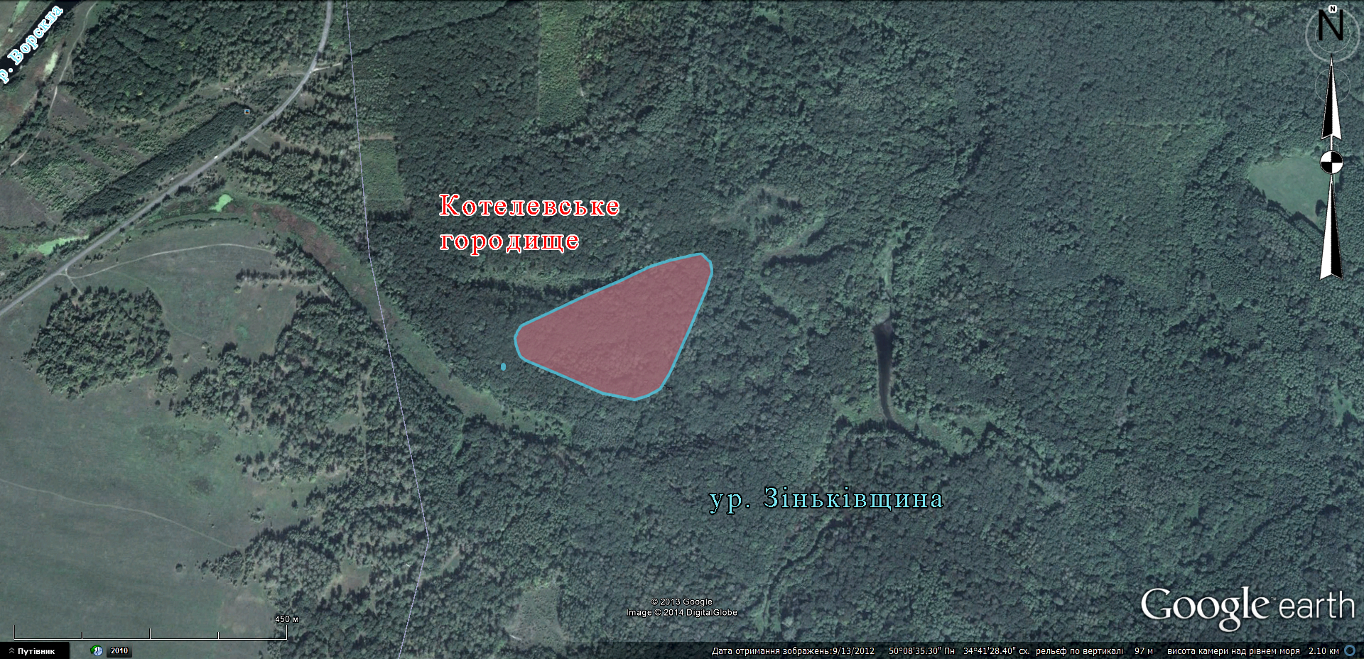
Котельва смт., Котелевське городище. Космічний фотознімок з нанесенням території укріплення. 2014 р.
Котельва смт., Котелевське городище. Північно-західна лінія укріплень. Фото 2013 р.
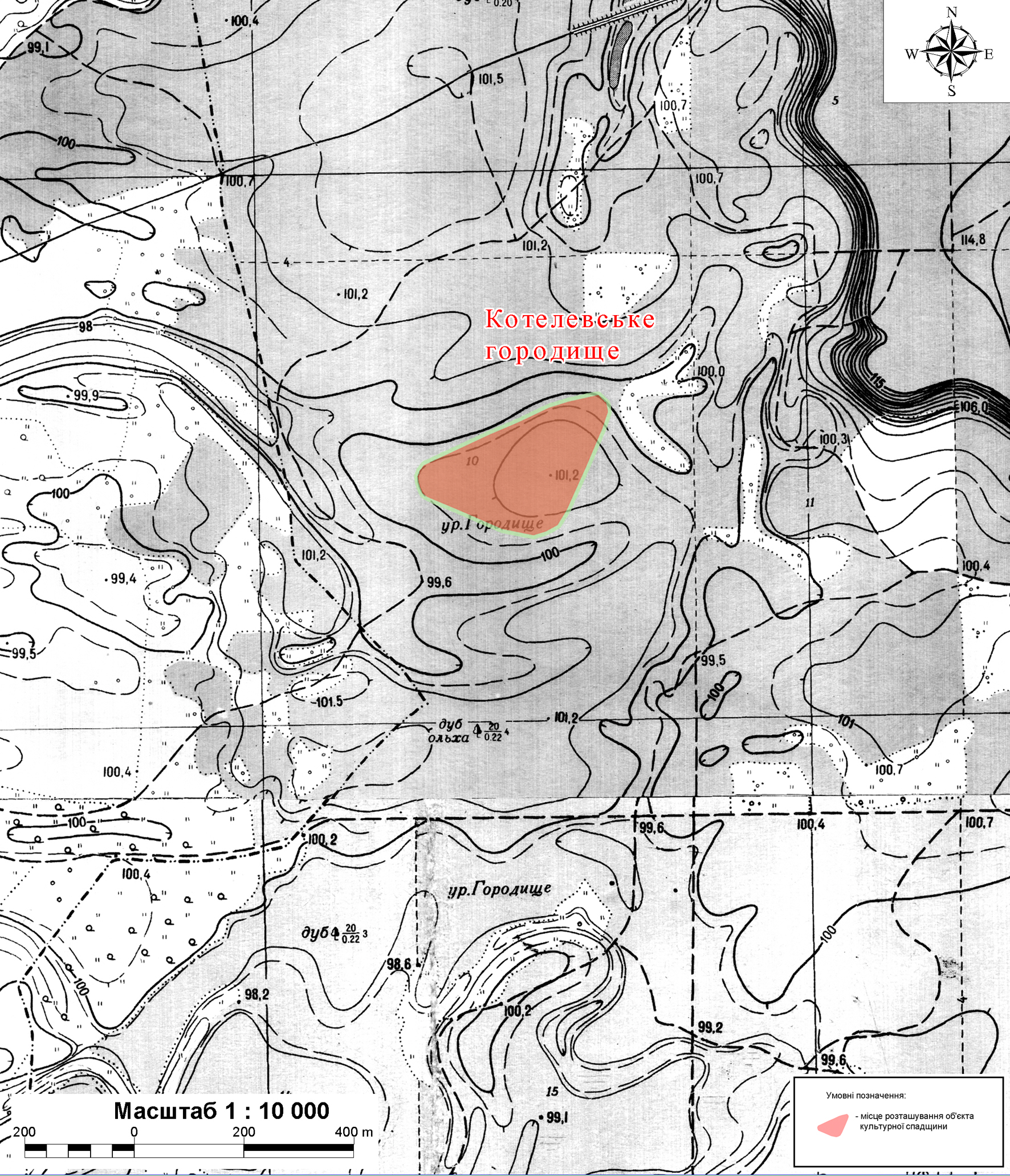
Котельва смт., Котелевське городище. Детальна карта місця розташування.
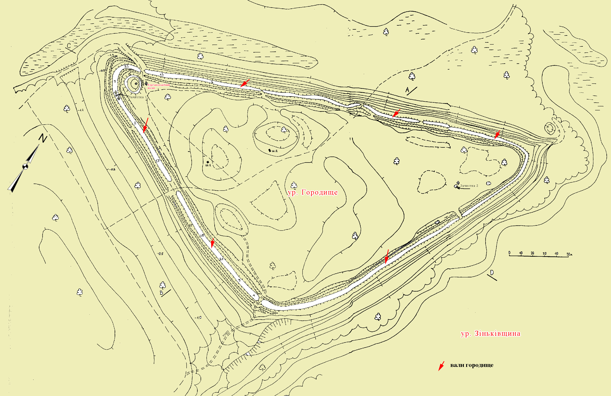
Котельва смт., Котелевське городище. Генеральний план з позначенням місць проведення досліджень 2000 р. та смуги валів (М 1: 1000). За О.Б. Супруненком, 2001 р., уточнення 2014 р. Умовні позначення: 1-3 – зачистка 1; 2 – зачищені відслонення; 4 – зачистка 2; ш – шурфи. Цифрами на валах (вказівники – стрілки червоного кольору) позначена відносна висота валу.
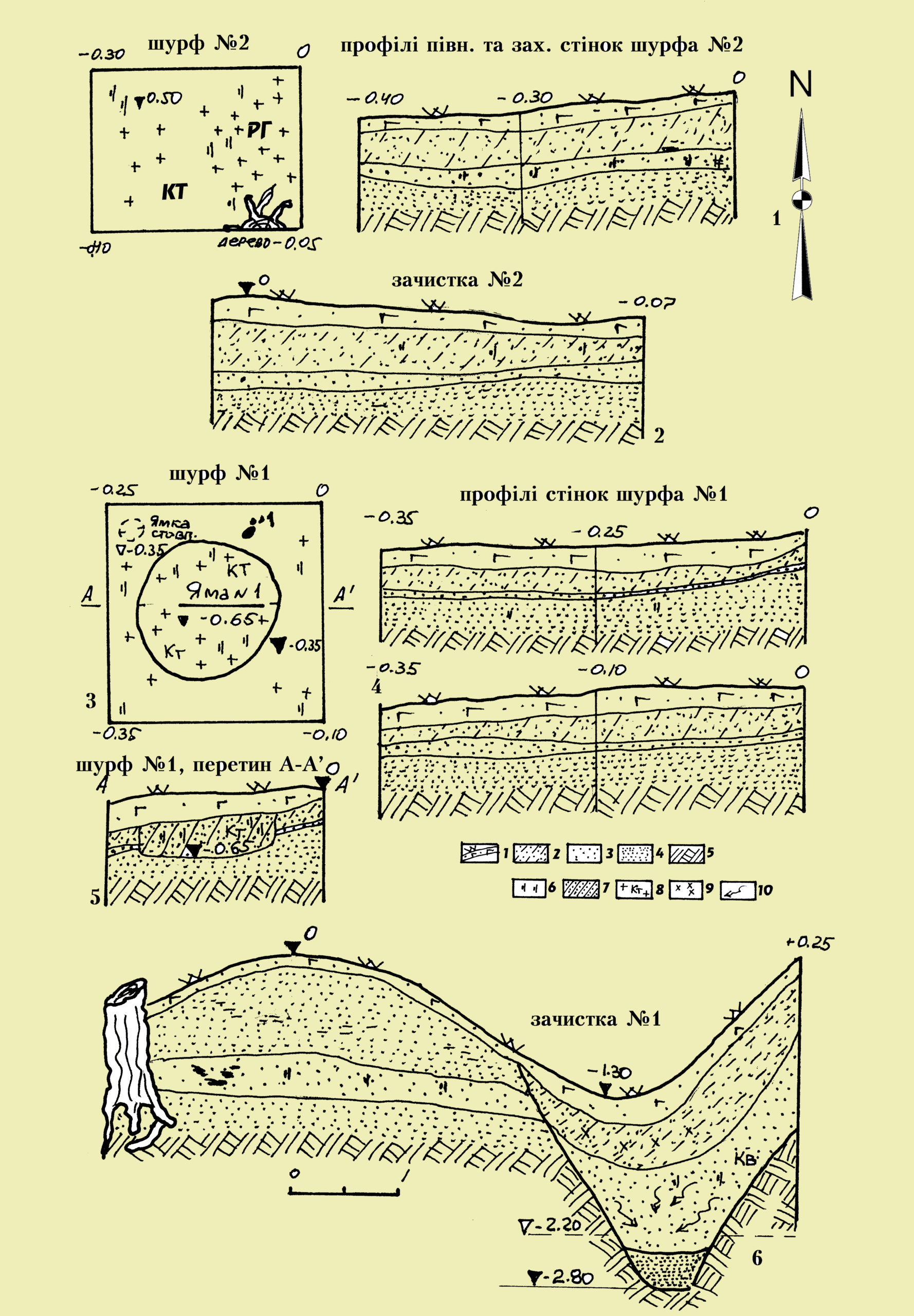
Котельва смт., Котелевське городище. Плани та профілі зачисток і шурфів. 1– шурф 2; 2 – зачистка 2; 3, 4 – шурф 1; 5 – перетин ями 1 у шурфі 2; 6 – зачистка 1 валу і рову. Умовні позначення: 1 – задернований шар лісового ґумусу; 2 – супіщаний культурний шар; 3 – пісок сіро-коричневого кольору; 4 – пісок палевого кольору; 5 – пісок-материк; 6 – вуглини; 7 – попелястий супісок; 8 – фрагменти ліпної кераміки і кістки тварин; 9 – уламки гончарного посуду XVII – XVIII ст.; 10 – затьоки.
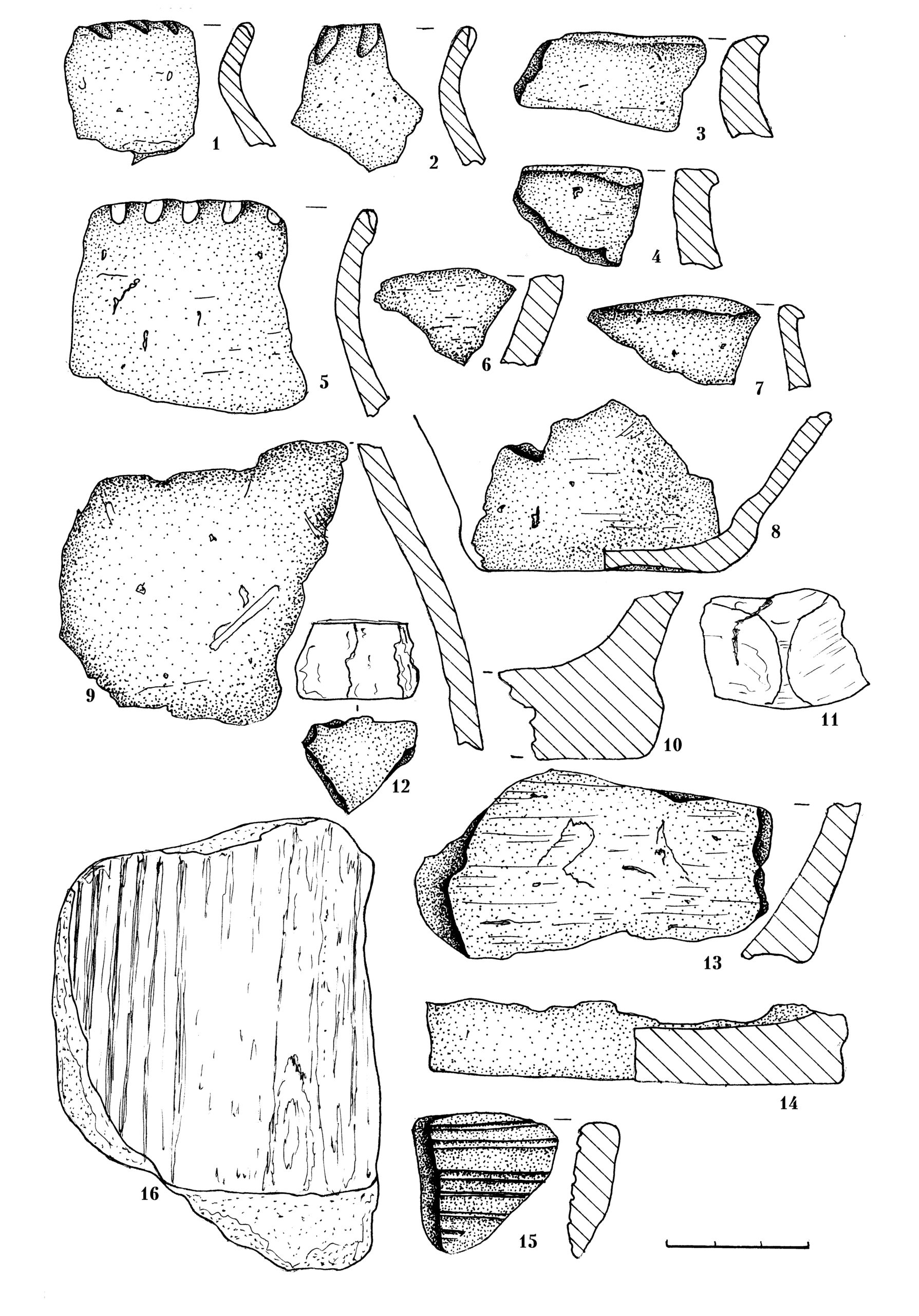
Котельва смт., Котелевське городище. Знахідки пізньоскіфського часу. 2000 р.
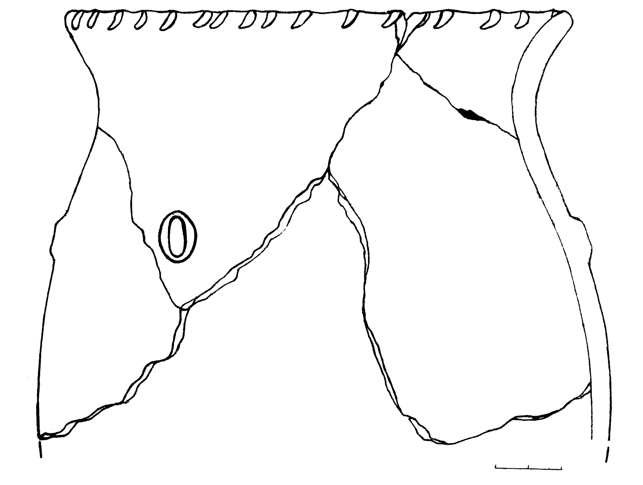
Котельва смт., Котелевське городище. Верхня частина пізньоскіфського ліпного горщика з шурфа 2. 2000 р. Кераміка.
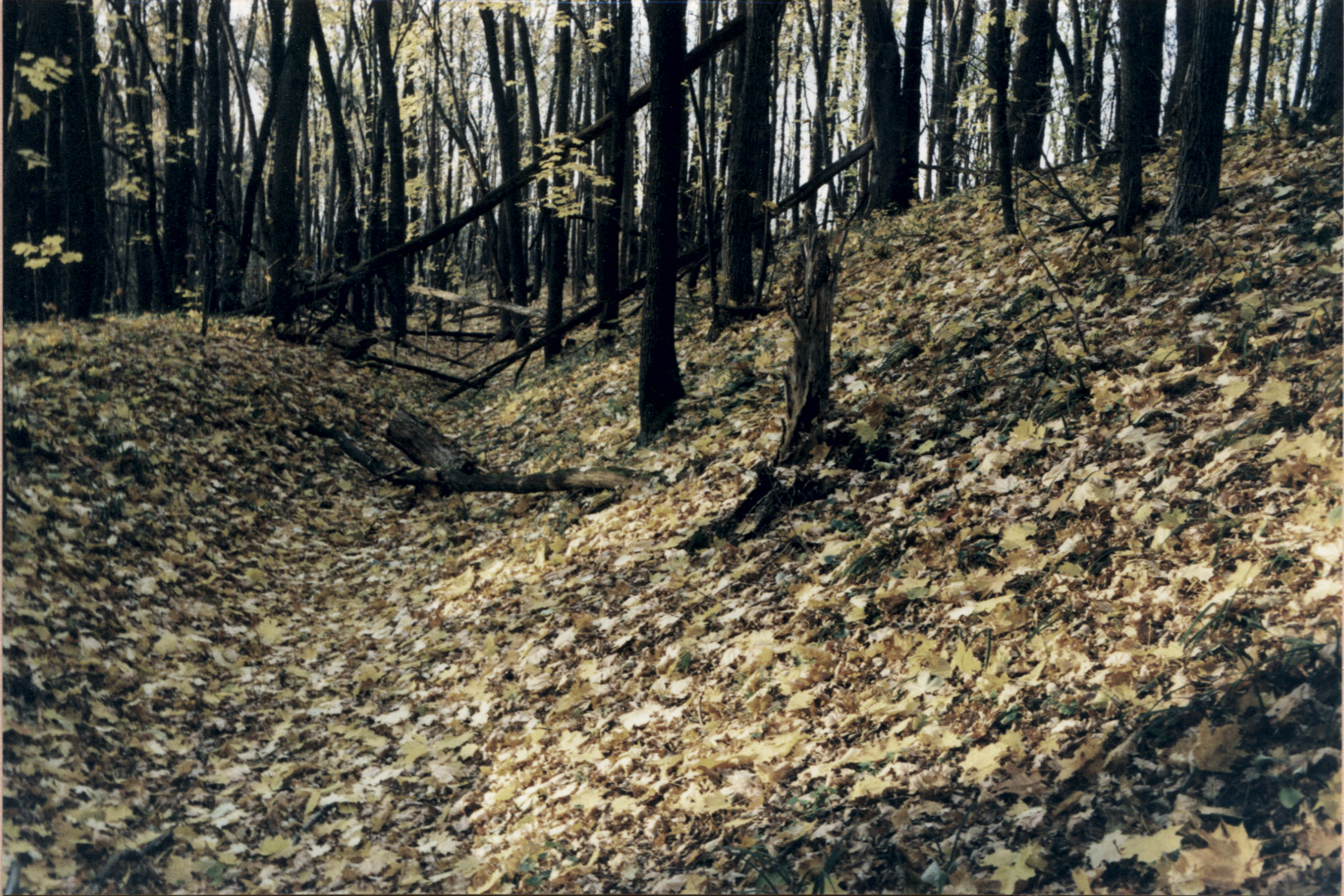
Котельва смт., Котелевське городище. Північно-західна ділянка укріплень. Вал і заглибина рову. Фото 2007 р.
Котельва смт., Котелевське городище. Північно-східна частина. Вхід. Фото 2007 р.
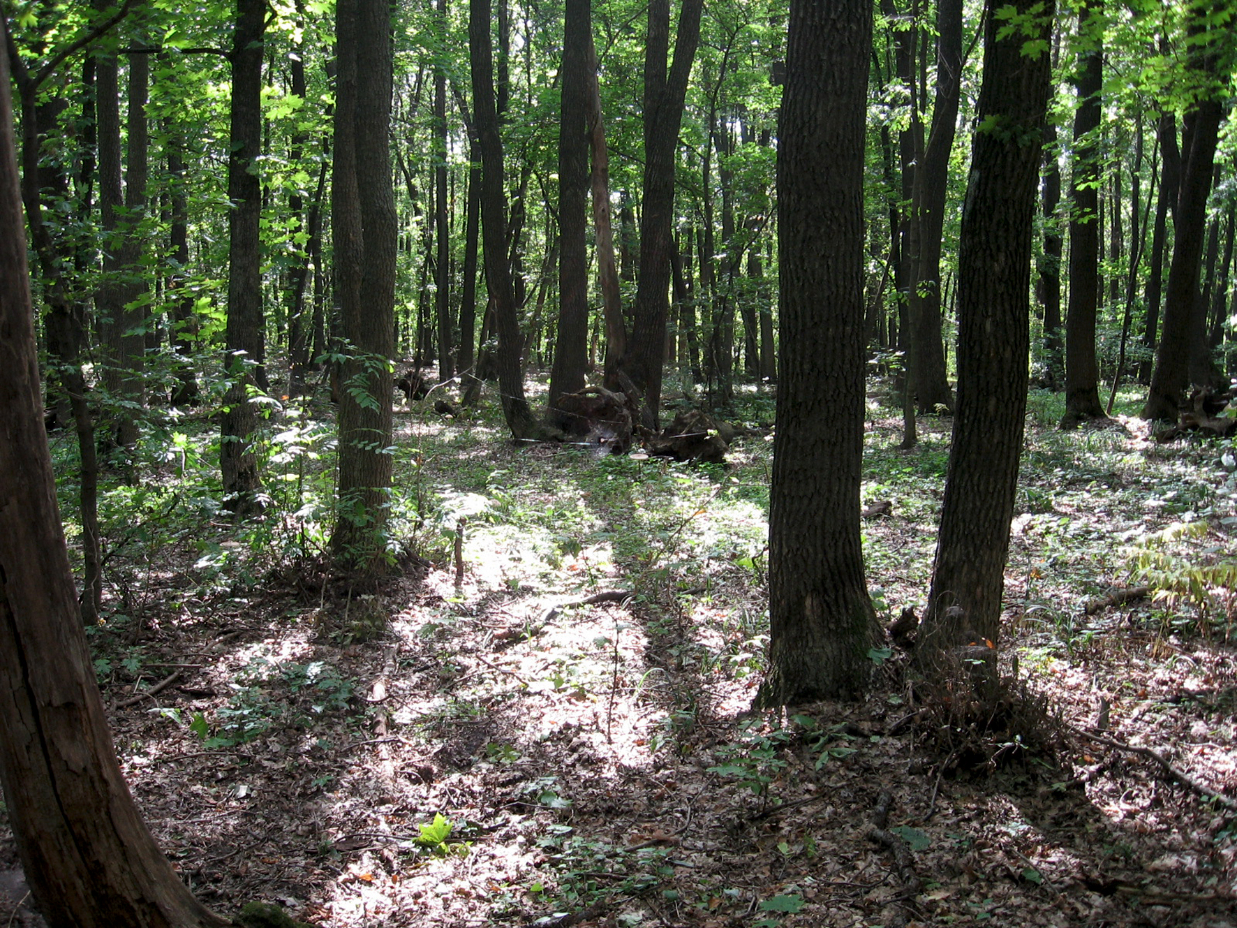
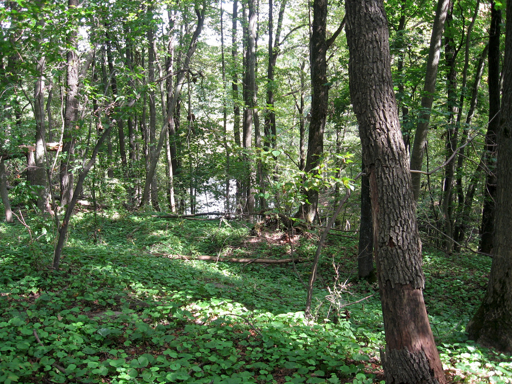
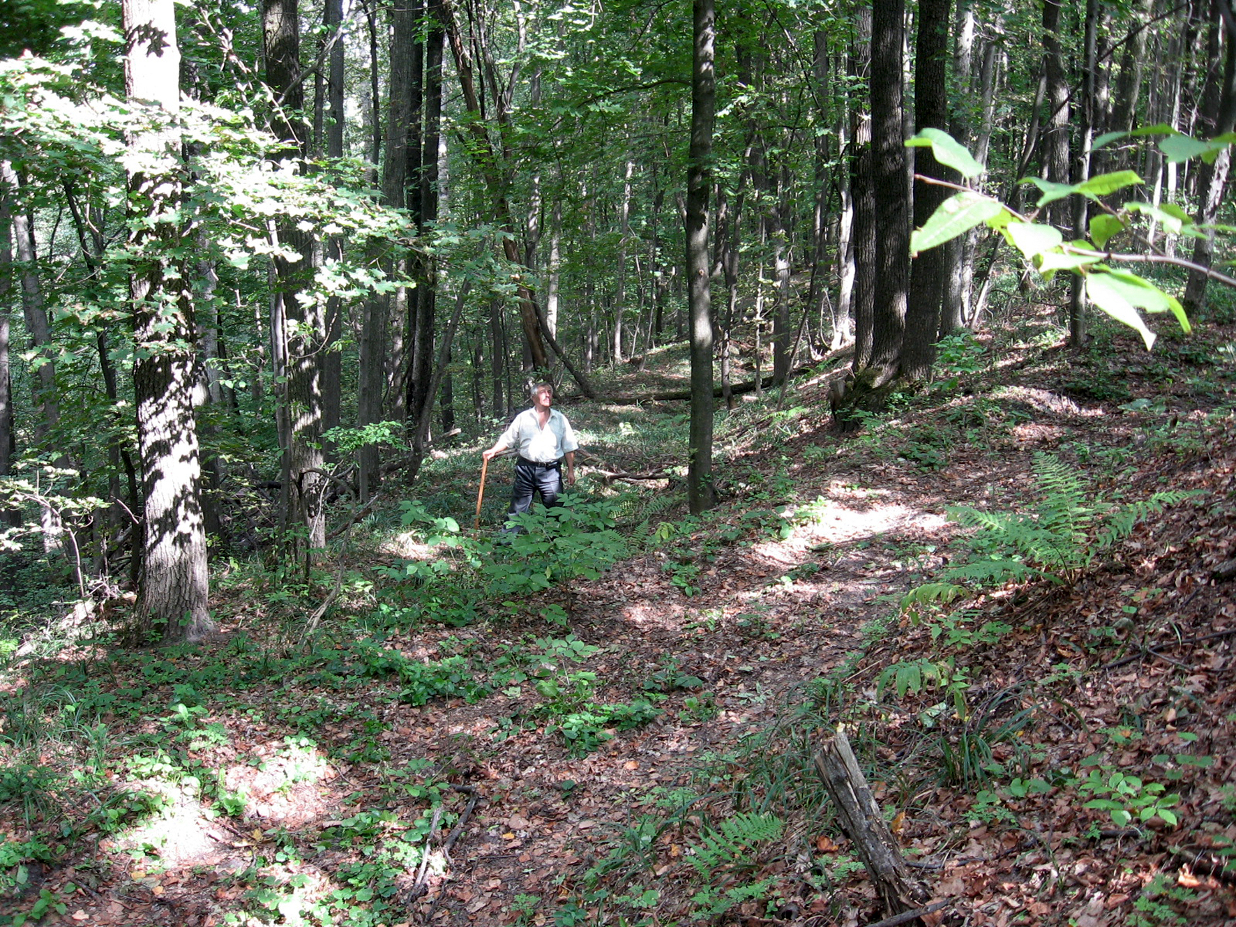
Котельва смт., Котелевське городище. Центральна частина. Характер заліснення майданчика. Фото 2013 р.
Котельва смт., Котелевське городище. Північно-східна частина. Вал і рів. Фото 2013 р.
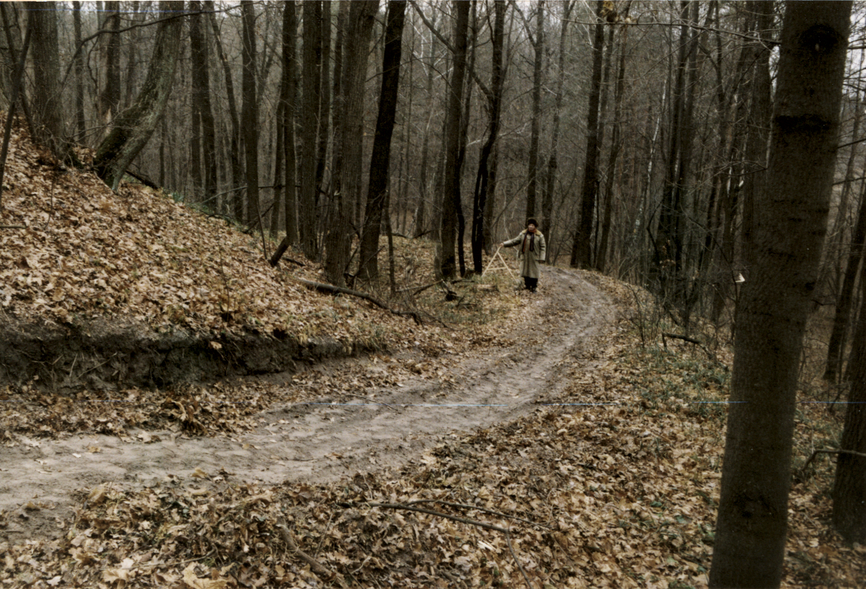
Котельва смт., Котелевське городище. Південно-західна частина. Вал, ескарповані схили та стара доріжка. Фото 2013 р.