It is located on the western edge of Brovarky village, Knyshivka Village Council, Hadiach district, Poltava region.
In 1902 M. Yu. Brandenburh, V. V. Khvoika and S.A. Mazaraki conducted the excavation of 10 big kurgans. In 1908 M. O. Makarenko conducted the excavation of 7 kurgans. It was surveyed by I. I. Liapushkin (1948) and V. A. Illinska (1954). In 1989 – 1993 excavations were conducted by P. Ya. Havrysh, she surveyed 5 kurgans more. Later, in 2007, it was examined by V.V. Sherstiuk.
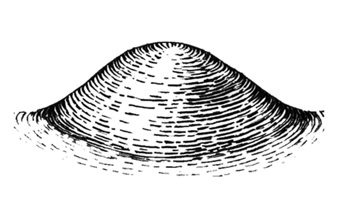
The mound occupies the plateau of the high right root bank of the Psеl River. The south-eastern part of the burial mound is located under the households of Brovarky village residents, the community yard, the school and the post office. Most of them currently have the height of 0.20 – 1 m. 5 big non – ploughed kurgans with the height from 5 to 12 m and the diameter of 30-60 m are preserved on the territory of the village. Their edges have been partially cropped by ploughing. Necropolis occupies the area of approximately 4.5 ha (1.5 x 0.3 km).
Despite the fact that necropolis had been constantly robbed in the ancient times, the burial inventory of the surveyed banks is represented by the samples of arms (iron acenaces swords, spear tips, arrowheads, bow details), armour (body armour), the parts of horse bridles, etc.
Brovarky burial mound is one of the biggest necropoli of the Scythian times in the Psel basin, represented by the highest kurgans in the Poltava region. According to P. Ya. Havrysh, the necropolis was left by the representatives of military druzhina (detachment) unit of nomadic noble origin belonging to the Early Scythian times. Later the burial mound was used for the burials of local agricultural and cattle-breeding people of the Psel basin, and in Slavonic and Old Russian times a complex comprising a fortified settlement, a township and a mound necropolis emerged on its south-western edge. The complex is widely known due to the surveys of V. V. Khvoika.
7th – 4th cc. BC, the Scythian times.
It is located on the western edge of Brovarky village, Knyshivka Village Council, Hadiach district, Poltava region.
In 1902 M. Yu. Brandenburh, V. V. Khvoika and S.A. Mazaraki conducted the excavation of 10 big kurgans. In 1908 M. O. Makarenko conducted the excavation of 7 kurgans. It was surveyed by I. I. Liapushkin (1948) and V. A. Illinska (1954). In 1989 – 1993 excavations were conducted by P. Ya. Havrysh, she surveyed 5 kurgans more. Later, in 2007, it was examined by V.V. Sherstiuk.
The mound occupies the plateau of the high right root bank of the Psеl River. The south-eastern part of the burial mound is located under the households of Brovarky village residents, the community yard, the school and the post office. Most of them currently have the height of 0.20 – 1 m. 5 big non – ploughed kurgans with the height from 5 to 12 m and the diameter of 30-60 m are preserved on the territory of the village. Their edges have been partially cropped by ploughing. Necropolis occupies the area of approximately 4.5 ha (1.5 x 0.3 km).
Despite the fact that necropolis had been constantly robbed in the ancient times, the burial inventory of the surveyed banks is represented by the samples of arms (iron acenaces swords, spear tips, arrowheads, bow details), armour (body armour), the parts of horse bridles, etc.
Brovarky burial mound is one of the biggest necropoli of the Scythian times in the Psel basin, represented by the highest kurgans in the Poltava region. According to P. Ya. Havrysh, the necropolis was left by the representatives of military druzhina (detachment) unit of nomadic noble origin belonging to the Early Scythian times. Later the burial mound was used for the burials of local agricultural and cattle-breeding people of the Psel basin, and in Slavonic and Old Russian times a complex comprising a fortified settlement, a township and a mound necropolis emerged on its south-western edge. The complex is widely known due to the surveys of V. V. Khvoika.
7th – 4th cc. BC, the Scythian times.
Read moreПам’яткоохоронна інформація
Monument protection information
Пам’ятка археології місцевого значення.
Наказ Міністерства культури, молоді та спорту України № 1062 від 25.02.2020 р.
охоронний номер 2033-Пл.
brovarki01c372103ec00372.docПам’ятка археології місцевого значення.
Наказ Міністерства культури, молоді та спорту України № 1062 від 25.02.2020 р.
охоронний номер 2033-Пл.
brovarki01c372103ec00372.docНаукові публікації
Scientific publications
Шерстюк В. Городище, селище і курганний могильник ранньослов’янського та давньоруського часів // Звід пам’яток історії та культури України: Полтавська область. Гадяцький район [Текст] = Register of Monuments of History and Culture of Ukraine: Poltava Region. Gadjach district / Полт. краєзн. муз.; B.A. Андрієць, С. І. Бочарова, О. О. Вільмовська та ін.; ред. кол.: Ю. В. Волошин, А. М. Киридон, В. В. Кривошея та ін.; [упорядн., наук. ред. В. О. Мокляк]. — Полтава: ТОВ «АСМІ», 2013. – С. 171-174
gadyaczkyj-zvod-brovarky-nekropol-miscz-pam-1.pdfШерстюк В. Городище, селище і курганний могильник ранньослов’янського та давньоруського часів // Звід пам’яток історії та культури України: Полтавська область. Гадяцький район [Текст] = Register of Monuments of History and Culture of Ukraine: Poltava Region. Gadjach district / Полт. краєзн. муз.; B.A. Андрієць, С. І. Бочарова, О. О. Вільмовська та ін.; ред. кол.: Ю. В. Волошин, А. М. Киридон, В. В. Кривошея та ін.; [упорядн., наук. ред. В. О. Мокляк]. — Полтава: ТОВ «АСМІ», 2013. – С. 171-174
gadyaczkyj-zvod-brovarky-nekropol-miscz-pam-1.pdfФотогалерея
Gallery
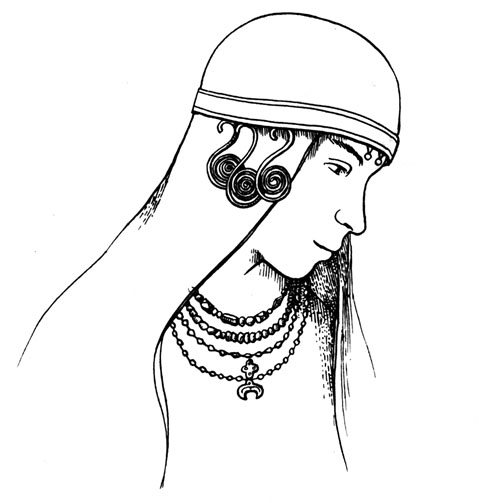
Броварки, с. Курганний некрополь слов'янського часу. Реконструкція зовнішнього вигляду чоловіка.