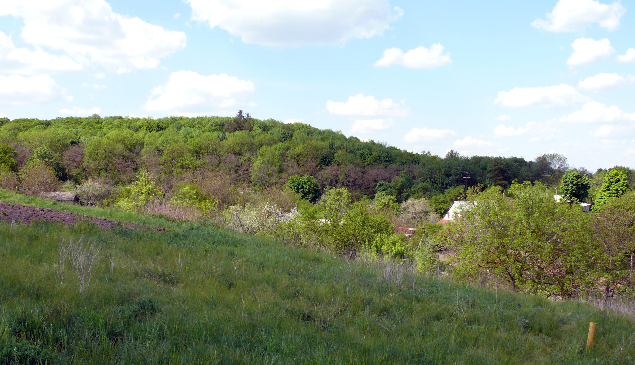
It is located in the north-western part of Mykhailivka village, Stasi Village Council, Dykanka district, Poltava region, in Brusiia (Horodyshche) natural landmark.
It was surveyed by O.B. Suprunenko, I.M. Kulatova and A. V. Heiko (1999), O.B. Suprunenko and V.V. Sherstiuk (2004 and 2011).
The archaeological complex is located on the cape of the right root bank of the Vorskla River and comprises a minor fortified settlement, a moat, a township, located on the residual close to the fortification foot and the remains of the kurgan necropolis.
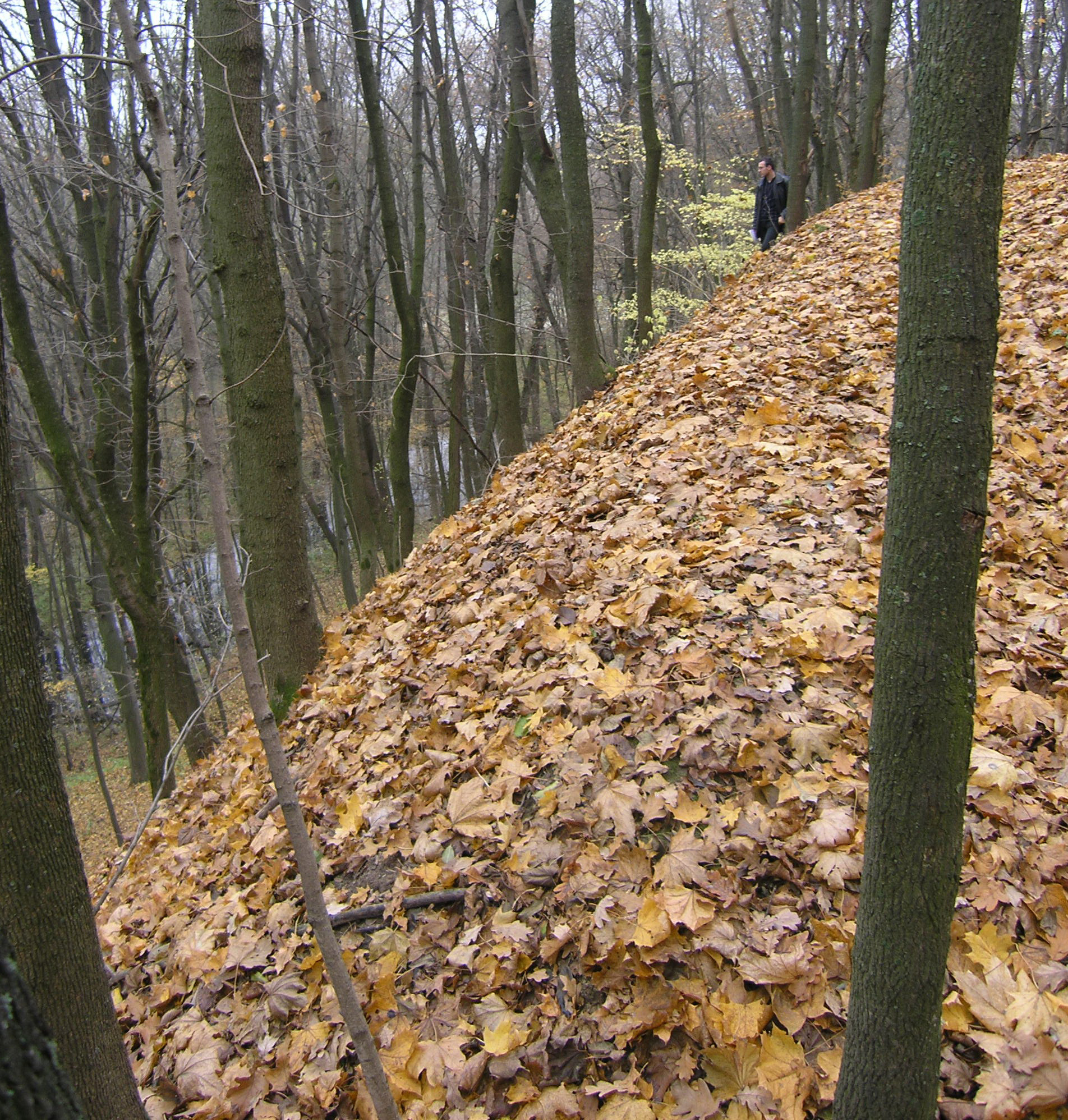
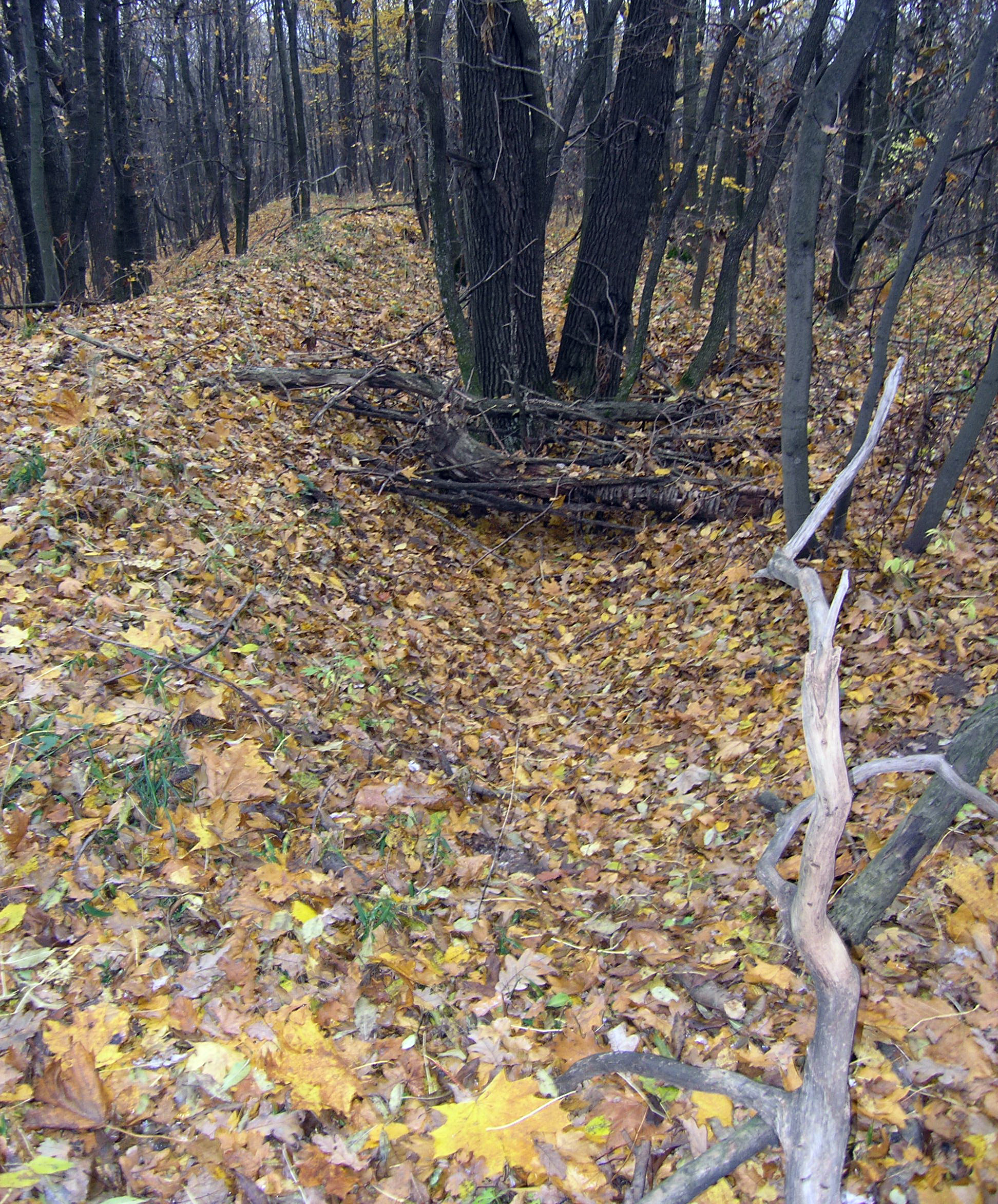
1. The support breastwork and the scarp are located along a narrow neck of land at the cape in latitude direction. The breastwork height makes up 0.6-1.0 m and the width of its base is 1.5-2.5 m. It stretches for approximately 125 m long. The surrounding slopes, especially the north-eastern one, still have the remains of scarping.
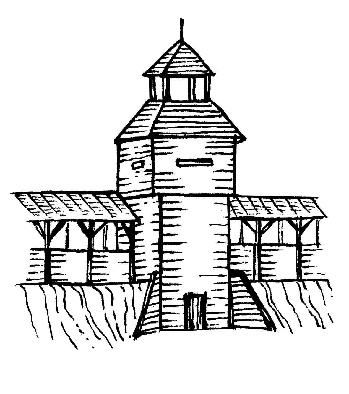
2. The fortified settlement is shaped on the plan as a rough oval, with dimensions of 44 х 52 m, surrounded by the bloated breastwork, 2.0-3.5 m high, the width of its base makes up 4.0-8.0 m. The eastern fortification side facing the enemy is protected by the much higher section of the breastwork, so-called “canopy”, up to 6.0 m from the bottom of the moat and with the width of approximately 14.0 m in its base. The area of the square, protected by the breastworks, is 27 х 30 m (0.08 ha). The square, fortifications and narrow neck surface is covered with sward and forestland, mainly horn-beech and oak trees. The cultural layers in the western part of the fortified settlement are found at the depth of 0.20-0.25 cm. Up to a depth of 0.40 m, there is a dense burnt chernozem (black soil) layer, which contains patches of red clay burnt at high temperatures, which comes from the filling of charred wooden structures of the breastwork and stands. The remains of the sandstone setting in the breastwork foundation have been discovered under it. An iron armour-piercing stalked arrowhead with oval and keel-shaped crossing of the 2nd half of 13th – 14th cc. has been discovered in the filling of the moat.
3. The remains of mound necropolis. 100-200 m from the fortified settlement breastwork, deeper into the cape territory there is a smaller kurgan-like high point, 0.50 m high, with a diameter of 15-18 m, which can supposedly be a remain of the Bronze Age- the Early Iron Age kurgan. Approximately 10 smaller sward-covered high points 0.15-0.70 m high and with a diameter of 4-8 m are observable a little further. They comply with the parameters of Late Romen or Old Russian kurgans. The excavations of sward-covered kurgans have not been conducted.
4. The township and trading quarters are located at the cape foot and occupy area of 0.75 hectares. The Romen culture moulded ceramics and pottery of the late Ukrainian Middle Ages can be found on its surface.
The findings are represented by the fragments of the moulded pots walls of the late stage of Romen culture. A spinning wheel made of pink Ovruch slate with a 1.0 cm hole in it was also discovered there. Local residents also mentioned the discovery of a grindstone made of pyrophyllite slate.
Mykhailivka fortified settlement is the only known Slavonic and Old Russian fortified settlement on the territory of Dykanka district in an ideally preserved condition.
10th –14th сc.; Romen culture, the Kyivan Rus period, post-Mongol times; 17th –18th cc., Cossacks times.
It is located in the north-western part of Mykhailivka village, Stasi Village Council, Dykanka district, Poltava region, in Brusiia (Horodyshche) natural landmark.
It was surveyed by O.B. Suprunenko, I.M. Kulatova and A. V. Heiko (1999), O.B. Suprunenko and V.V. Sherstiuk (2004 and 2011).
The archaeological complex is located on the cape of the right root bank of the Vorskla River and comprises a minor fortified settlement, a moat, a township, located on the residual close to the fortification foot and the remains of the kurgan necropolis.
1. The support breastwork and the scarp are located along a narrow neck of land at the cape in latitude direction. The breastwork height makes up 0.6-1.0 m and the width of its base is 1.5-2.5 m. It stretches for approximately 125 m long. The surrounding slopes, especially the north-eastern one, still have the remains of scarping.
2. The fortified settlement is shaped on the plan as a rough oval, with dimensions of 44 х 52 m, surrounded by the bloated breastwork, 2.0-3.5 m high, the width of its base makes up 4.0-8.0 m. The eastern fortification side facing the enemy is protected by the much higher section of the breastwork, so-called “canopy”, up to 6.0 m from the bottom of the moat and with the width of approximately 14.0 m in its base. The area of the square, protected by the breastworks, is 27 х 30 m (0.08 ha). The square, fortifications and narrow neck surface is covered with sward and forestland, mainly horn-beech and oak trees. The cultural layers in the western part of the fortified settlement are found at the depth of 0.20-0.25 cm. Up to a depth of 0.40 m, there is a dense burnt chernozem (black soil) layer, which contains patches of red clay burnt at high temperatures, which comes from the filling of charred wooden structures of the breastwork and stands. The remains of the sandstone setting in the breastwork foundation have been discovered under it. An iron armour-piercing stalked arrowhead with oval and keel-shaped crossing of the 2nd half of 13th – 14th cc. has been discovered in the filling of the moat.
3. The remains of mound necropolis. 100-200 m from the fortified settlement breastwork, deeper into the cape territory there is a smaller kurgan-like high point, 0.50 m high, with a diameter of 15-18 m, which can supposedly be a remain of the Bronze Age- the Early Iron Age kurgan. Approximately 10 smaller sward-covered high points 0.15-0.70 m high and with a diameter of 4-8 m are observable a little further. They comply with the parameters of Late Romen or Old Russian kurgans. The excavations of sward-covered kurgans have not been conducted.
4. The township and trading quarters are located at the cape foot and occupy area of 0.75 hectares. The Romen culture moulded ceramics and pottery of the late Ukrainian Middle Ages can be found on its surface.
The findings are represented by the fragments of the moulded pots walls of the late stage of Romen culture. A spinning wheel made of pink Ovruch slate with a 1.0 cm hole in it was also discovered there. Local residents also mentioned the discovery of a grindstone made of pyrophyllite slate.
Mykhailivka fortified settlement is the only known Slavonic and Old Russian fortified settlement on the territory of Dykanka district in an ideally preserved condition.
10th –14th сc.; Romen culture, the Kyivan Rus period, post-Mongol times; 17th –18th cc., Cossacks times.
Read moreПам’яткоохоронна інформація
Monument protection information
Пам’ятка археології національного значення.
Постанова Кабінету Міністрів України від 03.09.2009 № 928.
охоронний номер 160016-Н.
myhaylivka-iii-pasport.pdfПам’ятка археології національного значення.
Постанова Кабінету Міністрів України від 03.09.2009 № 928.
охоронний номер 160016-Н.
myhaylivka-iii-pasport.pdfНаукові публікації
Scientific publications

Мироненко К. Супруненко О. Археологічний комплекс Михайлівка (Брусія) ІІ, ур. Брусія // Звід пам’яток історії та культури України: Полтавська область. Диканський район [Текст] = Register of Monuments of History and Culture of Ukraine: Poltava Region. Dikanka district/ [упорядн., наук. ред. В. О. Мокляк]; автори статей: В. А. Андрієць, В. М. Бака, Т. А. Бобровський та ін. — Полтава: ТОВ «АСМІ», 2011. – С. 174-177
dykanskyj-zvod-myhajlivka-ii-miscz-pam.pdfМироненко К. Супруненко О. Археологічний комплекс Михайлівка (Брусія) ІІ, ур. Брусія // Звід пам’яток історії та культури України: Полтавська область. Диканський район [Текст] = Register of Monuments of History and Culture of Ukraine: Poltava Region. Dikanka district/ [упорядн., наук. ред. В. О. Мокляк]; автори статей: В. А. Андрієць, В. М. Бака, Т. А. Бобровський та ін. — Полтава: ТОВ «АСМІ», 2011. – С. 174-177
dykanskyj-zvod-myhajlivka-ii-miscz-pam.pdfФотогалерея
Gallery
Михайлівка, с. Городище та поселення. Загальний вигляд. Фото 2011 р.
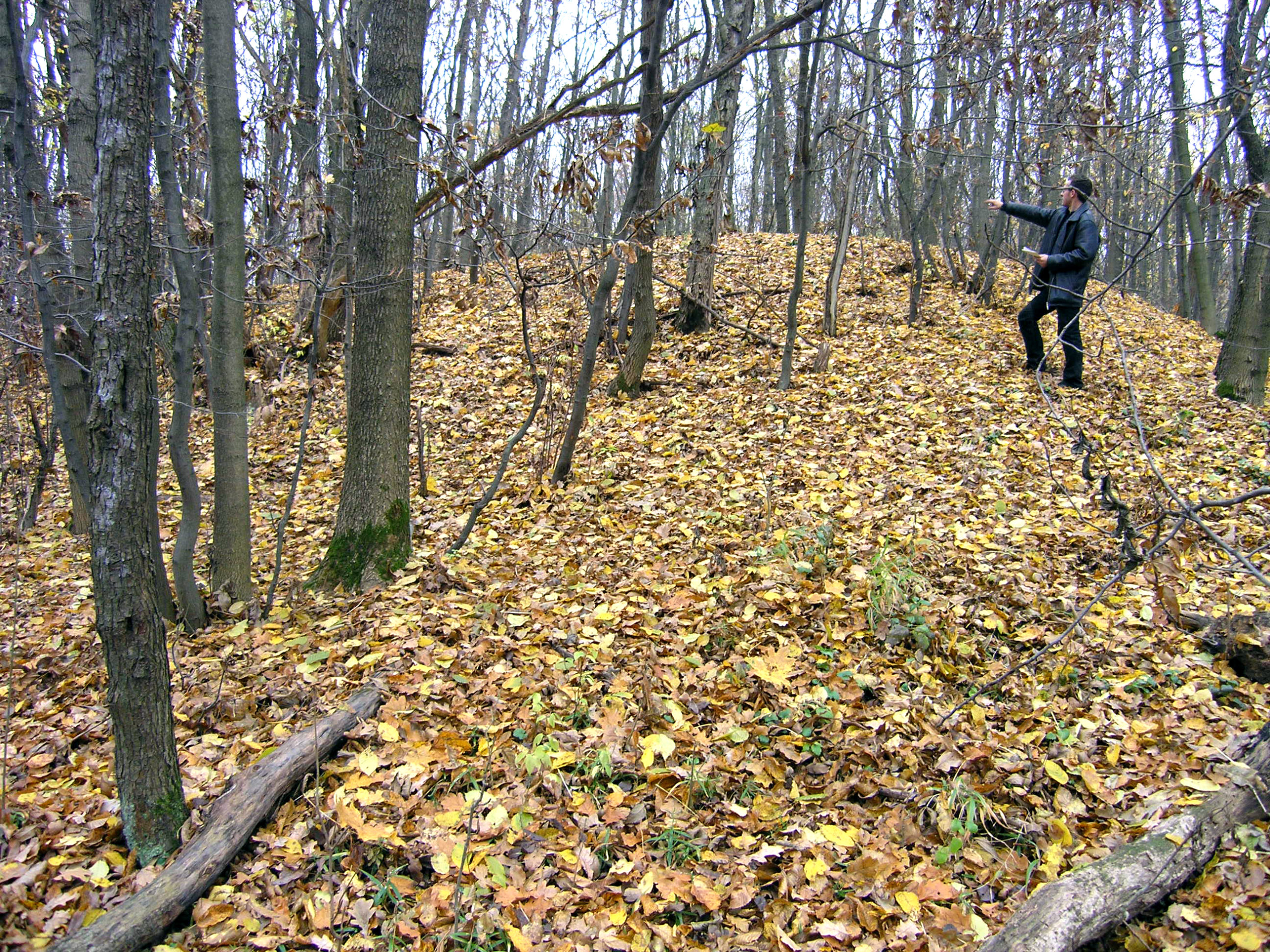
Михайлівка, с. Городище та поселення. Залишки валу у східному секторі укріплення. Фото 2004 р.
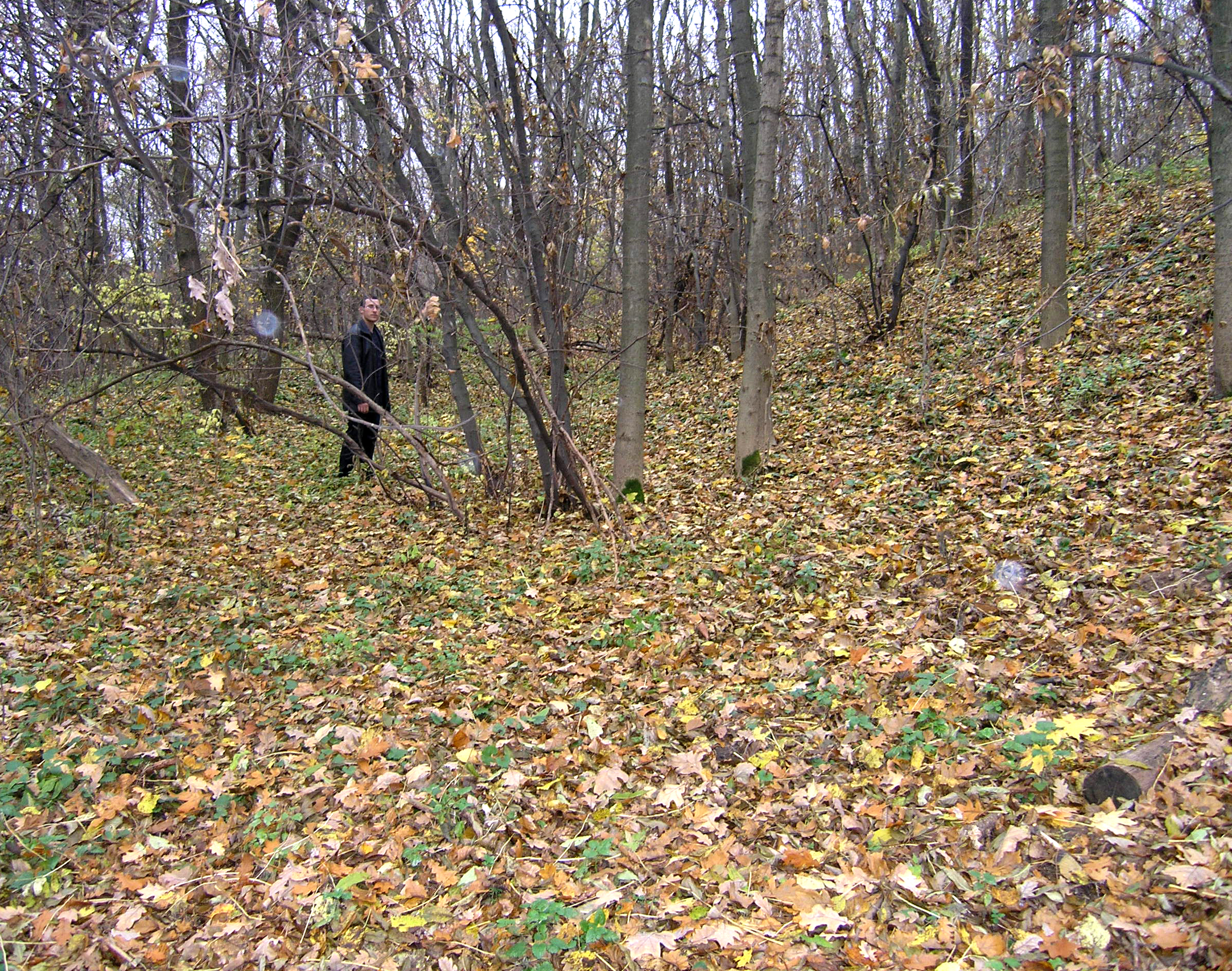
Михайлівка, с. Городище та поселення. Залишки валу та рову. Фото 2004 р.
Михайлівка, с. Городище та поселення. Північний ескарпований схил мису. Фото 2004 р.
Михайлівка, с. Городище та поселення. Залишки валу з північного заходу. Фото 2004 р.