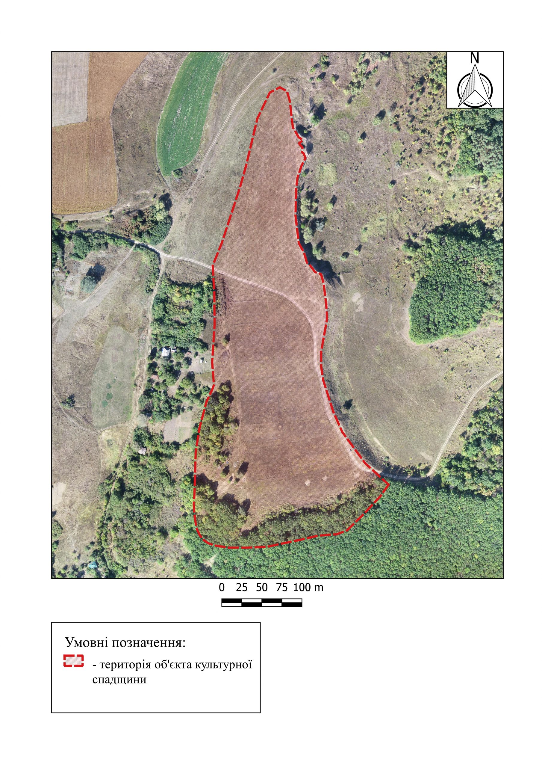
It is located in the northern edge of Opishnia village, Opishnia Village Council, Zinkiv district, Poltava region, in Kardashiv Val natural landmark, 6 km to the south of Velyke Bilske fortified settlement.
It was surveyed by V.H. Liaskoronskyi (early 20th c.); archaeological researches (excavations) were carried out by I.I. Liapushkin (1940), H.T. Kovpanenko (1950), later it was inspected by employees of the Poltava Museum of Local Lore and the National Museum-Reserve of Ukrainian Pottery. In 2001-2002, the excavations led by A.V. Heiko were carried out on the fortified settlement.
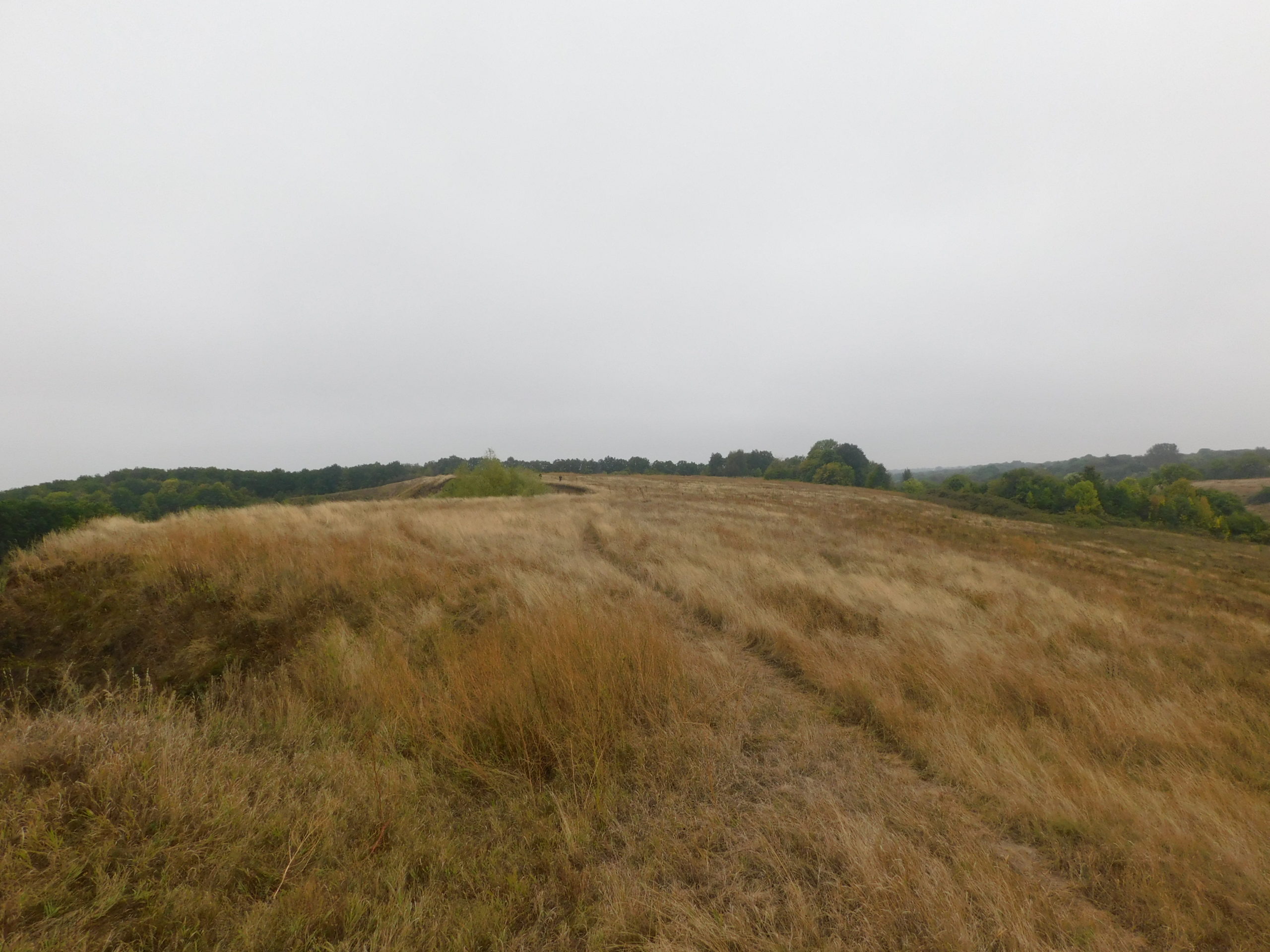
The Scythian fortified settlement occupies a long narrow cape on the right root bank of the Vorskla River.
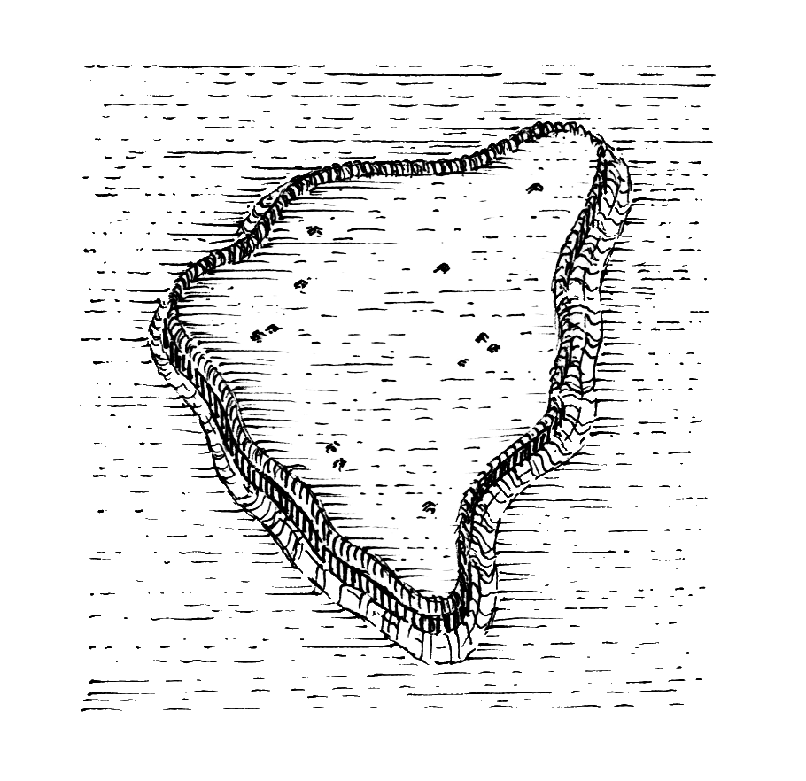
The ancient inhabitants chose the central part of the cape for settlement, separating it with a moat and a breastwork (up to 2.0 m high). An escarpment of 6-11 m high can be traced on the fortified settlement in the southern and south-eastern and south-western parts.
The moat was crossed in the south-eastern part of the fortified settlement. Three moats operating at different times of the fortified settlement’s existence are partially traced. Hence the bronze arrowhead of 5th-4th cc. BC was found here.
In 2001-2002, the moat was excavated.
The excavated area was established in the fortified settlement itself. Another moat was revealed on its southern edge, which is located on the site of the cape. The width of the excavated moat is 6.9 m. The depth is 3.68 m. The remains of a large fire can be traced in the moat filling.
This fortified settlement was part of several Povorskla fortifications, the centre of which was Bilske fortified settlement.
It is located in the northern edge of Opishnia village, Opishnia Village Council, Zinkiv district, Poltava region, in Kardashiv Val natural landmark, 6 km to the south of Velyke Bilske fortified settlement.
It was surveyed by V.H. Liaskoronskyi (early 20th c.); archaeological researches (excavations) were carried out by I.I. Liapushkin (1940), H.T. Kovpanenko (1950), later it was inspected by employees of the Poltava Museum of Local Lore and the National Museum-Reserve of Ukrainian Pottery. In 2001-2002, the excavations led by A.V. Heiko were carried out on the fortified settlement.
The Scythian fortified settlement occupies a long narrow cape on the right root bank of the Vorskla River.
The ancient inhabitants chose the central part of the cape for settlement, separating it with a moat and a breastwork (up to 2.0 m high). An escarpment of 6-11 m high can be traced on the fortified settlement in the southern and south-eastern and south-western parts.
The moat was crossed in the south-eastern part of the fortified settlement. Three moats operating at different times of the fortified settlement’s existence are partially traced. Hence the bronze arrowhead of 5th-4th cc. BC was found here.
In 2001-2002, the moat was excavated.
The excavated area was established in the fortified settlement itself. Another moat was revealed on its southern edge, which is located on the site of the cape. The width of the excavated moat is 6.9 m. The depth is 3.68 m. The remains of a large fire can be traced in the moat filling.
This fortified settlement was part of several Povorskla fortifications, the centre of which was Bilske fortified settlement.
Read moreПам’яткоохоронна інформація
Monument protection information
Пам’ятка археології місцевого значення.
Наказ Міністерства культури, молоді та спорту України № 1062 від 25.02.2020 р.
охоронний номер 2203-Пл.
Пам’ятка археології місцевого значення.
Наказ Міністерства культури, молоді та спорту України № 1062 від 25.02.2020 р.
охоронний номер 2203-Пл.
Наукові публікації
Scientific publications
Ляпушкин И. И. Археологические памятники эпохи железа в бассейне среднего течения р. Ворсклы (г. Полтава – с. Бельск) / И. И. Ляпушкин // КС ИИМК. ― Т. ХVІІ. ― 1947. ― С. 123 ― 132.
ksyymk-xvii-1947-lyapushkyn-1.pdfЛяпушкин И. И. Археологические памятники эпохи железа в бассейне среднего течения р. Ворсклы (г. Полтава – с. Бельск) / И. И. Ляпушкин // КС ИИМК. ― Т. ХVІІ. ― 1947. ― С. 123 ― 132.
ksyymk-xvii-1947-lyapushkyn-1.pdf
Фотогалерея
Gallery
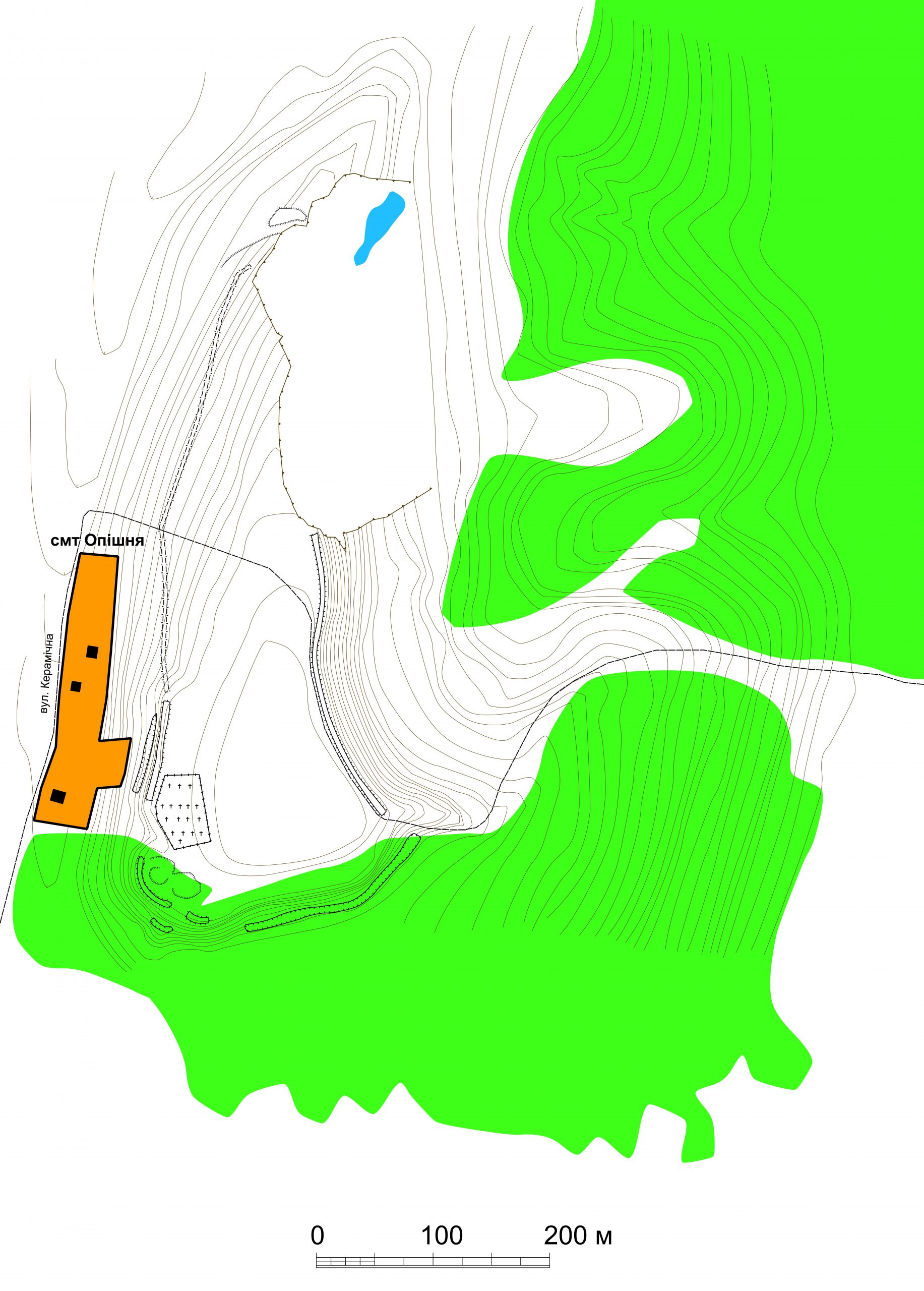
Опішня, смт. Городище «Кардашів Вал». Детальний план розташування городища за О.В. Коротею.
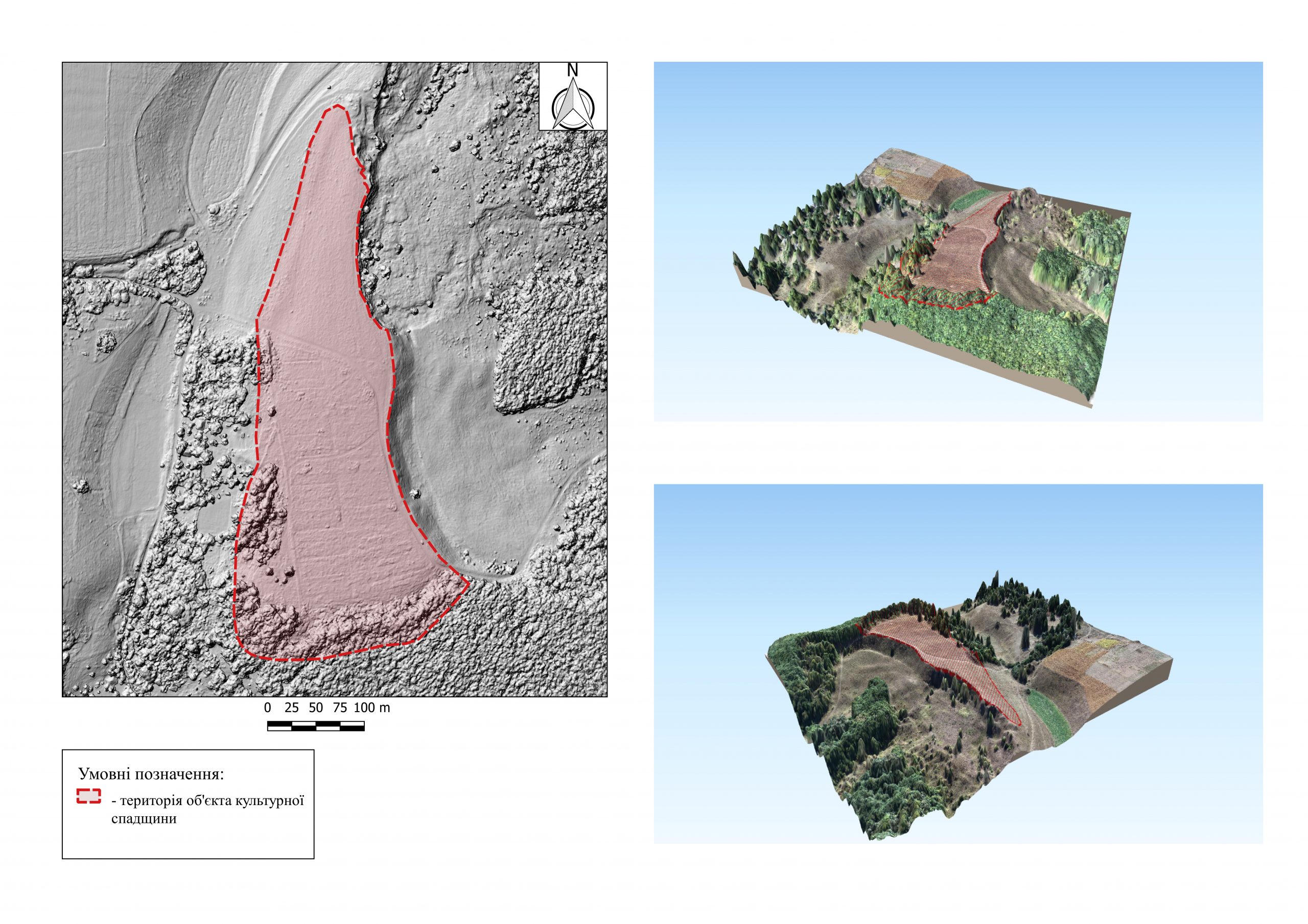
Опішня, смт. Городище «Кардашів Вал». Вид городища за 3-D моделью.
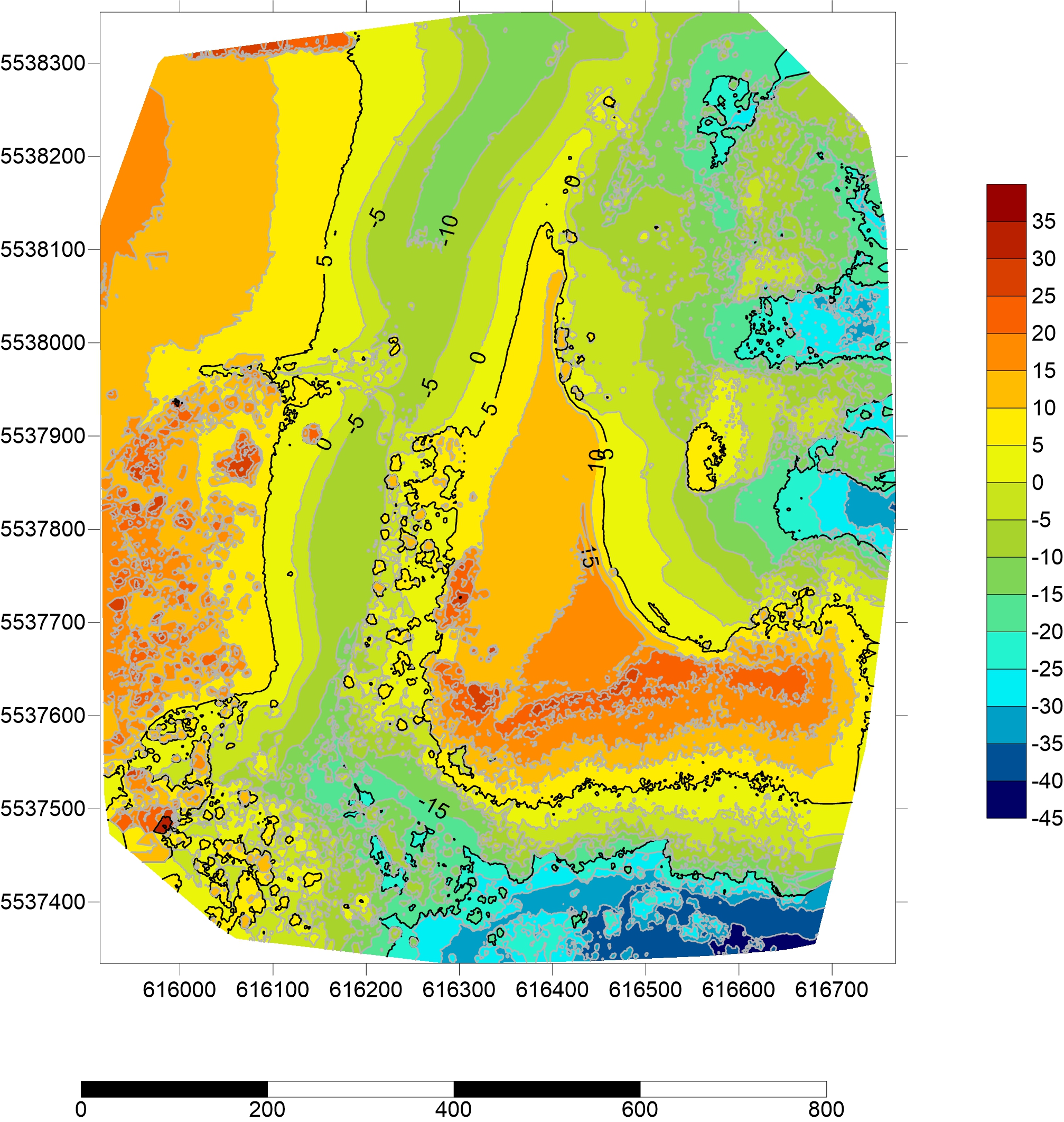
Опішня, смт. Городище «Кардашів Вал». Гіпсометрична модель.
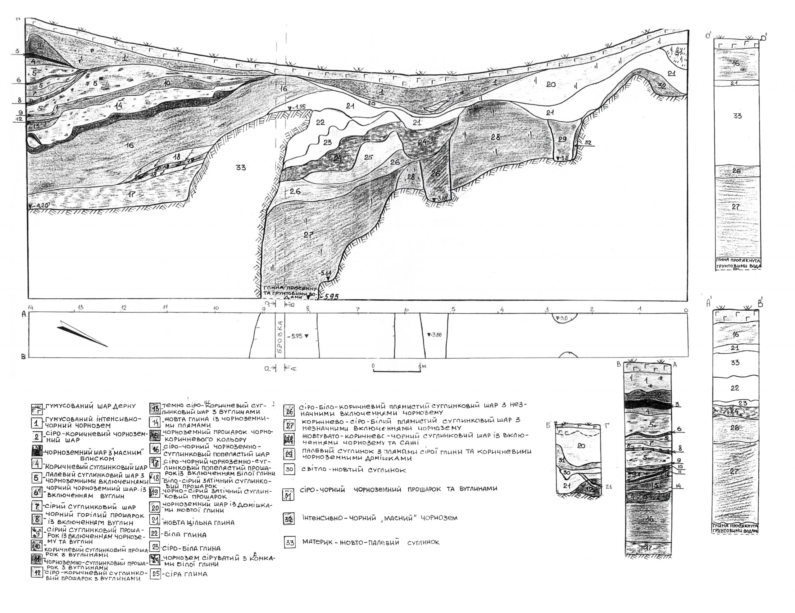
Опішня, смт. Городище «Кардашів Вал». Креслення перетину валу та рову за А.В. Гейком. 2001 р
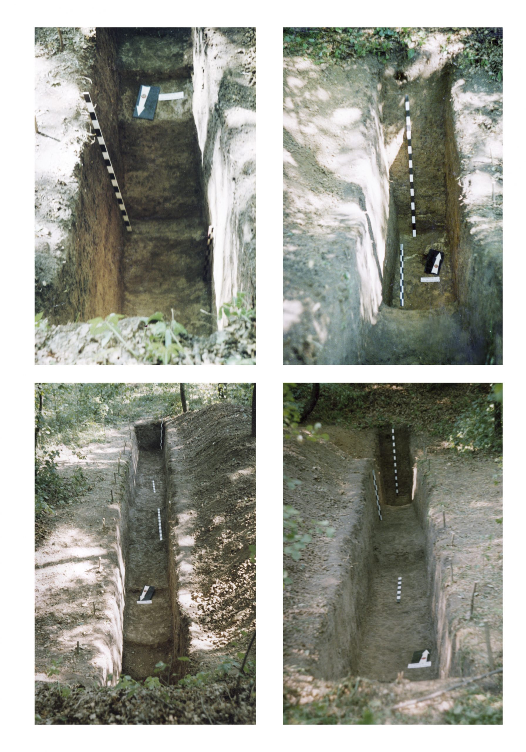
Опішня, смт. Городище «Кардашів Вал». Перетин валу та рову городища. Дослідження А.В. Гейка. Фото 2001 р.
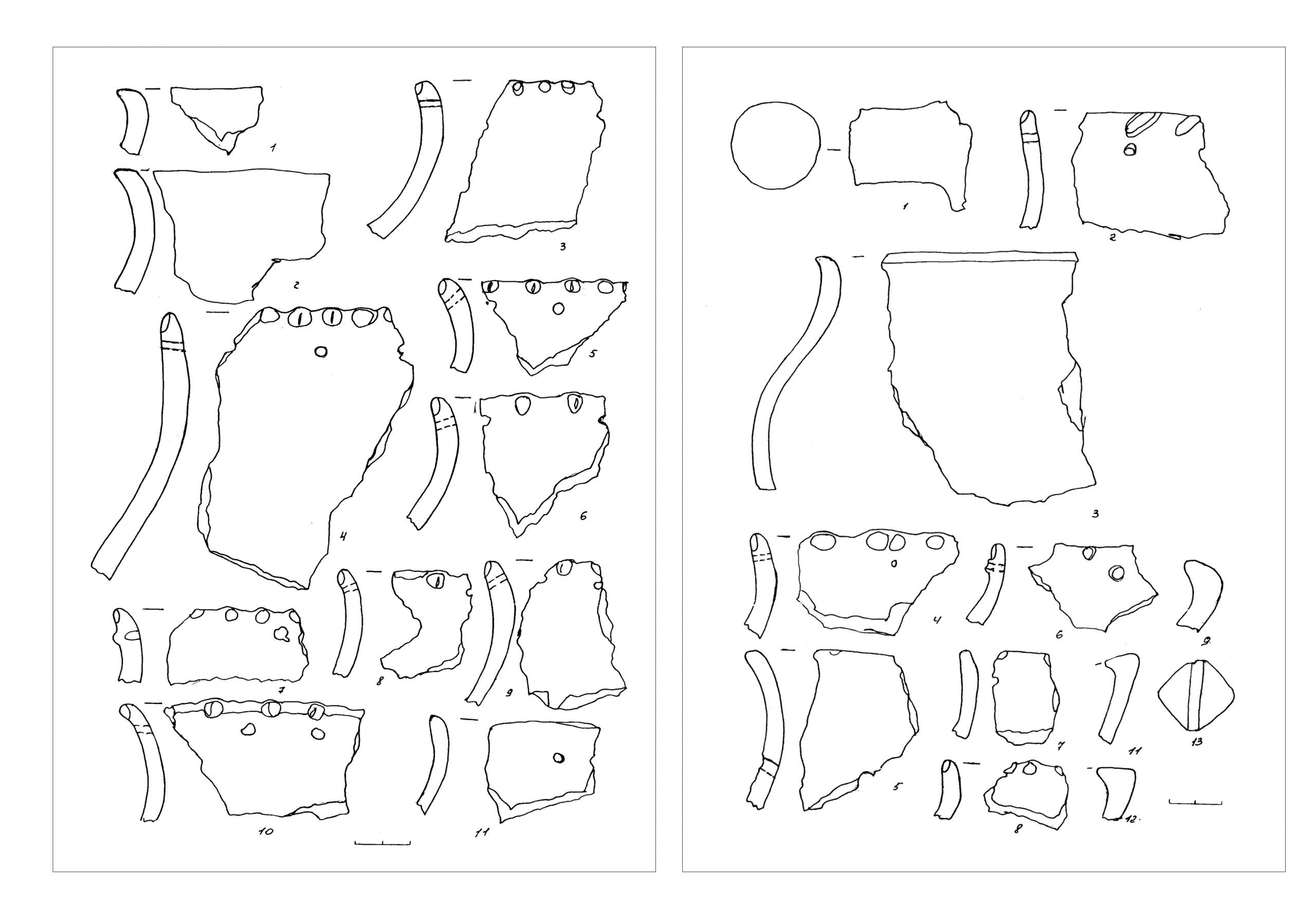
Опішня, смт. Городище «Кардашів Вал».. Знахідки з розкопок. Дослідження А.В. Гейка 2001-2002 рр.
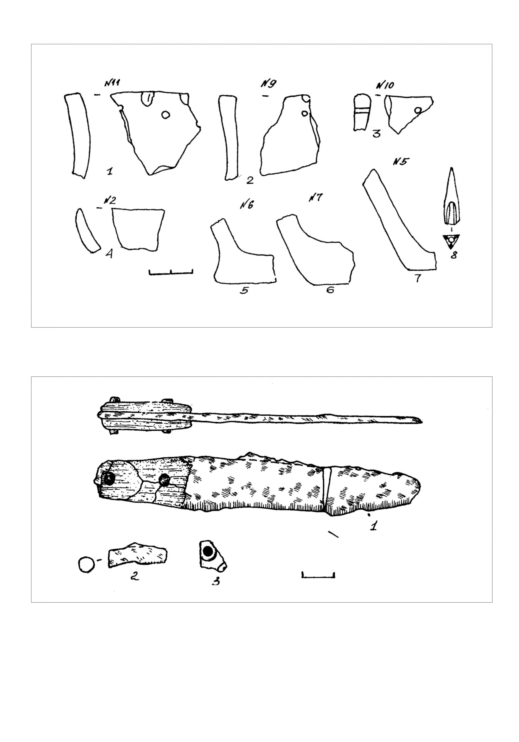
Опішня, смт. Городище «Кардашів Вал». Знахідки з розкопок. Дослідження А.В. Гейка 2001-2002 рр.