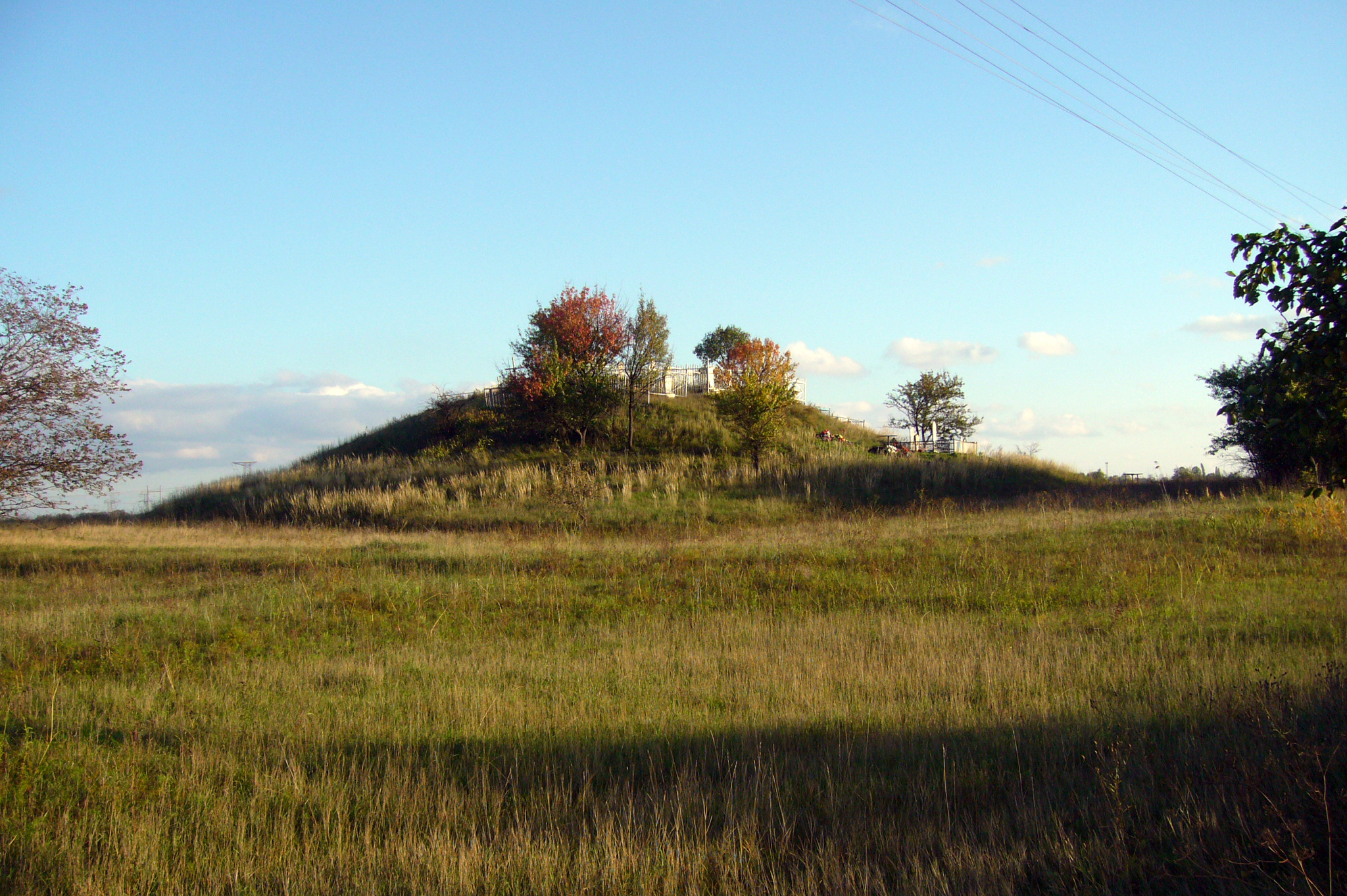
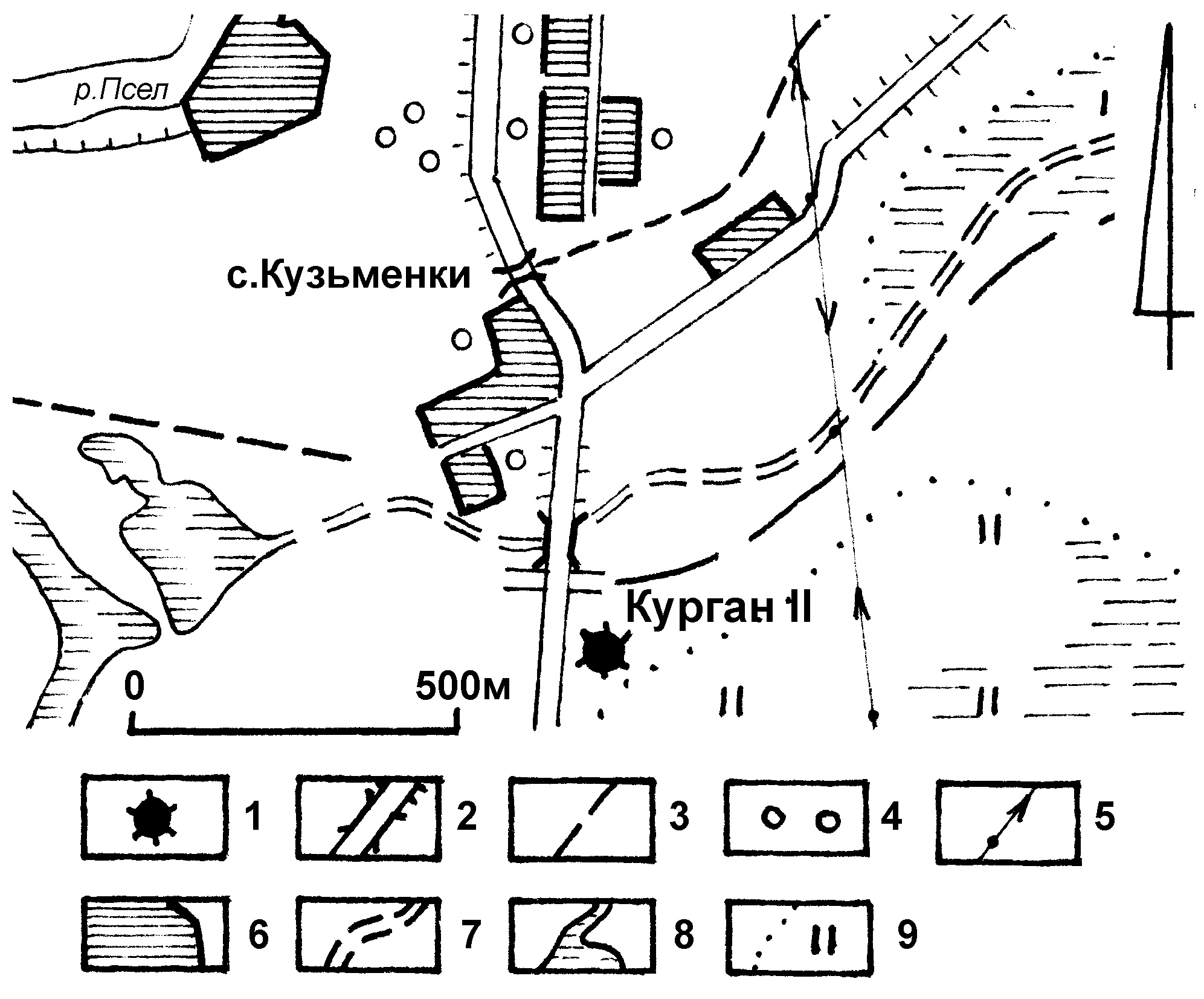
It is located near Kuzmenky village, Dmytrivka Village Council, Horishni Plavni City Council, 0.36 km to the south of the village, 0.85 km to the north of Kyiashky village, 3.22 km to the north of the Executive Committee building of Dmytrivka Village Council, directly along the highway Potoky station-Reshylylivka village.
Dimensions (height x diameter): 7.30x43x48 m System coordinates (WGS-84): N (latitude) 49º8´21.27´´E (longitude) 33º36´56.69´´.
4th – 1st millennium BC, the Chalcolithic Age – Early Iron Age.
It was examined by H.I. Sydorenko in 1972; it was surveyed by H.M. Nekrasova in 1986.
Пам’яткоохоронна інформація
Monument protection information
Пам’ятка археології місцевого значення.
Наказ Міністерства культури України № 228 від 27.03.2013, додаток 3, п. 23.
охоронний номер 4686-Пл.
kuzmenky-kii-pasport.pdfПам’ятка археології місцевого значення.
Наказ Міністерства культури України № 228 від 27.03.2013, додаток 3, п. 23.
охоронний номер 4686-Пл.
kuzmenky-kii-pasport.pdfФотогалерея
Gallery
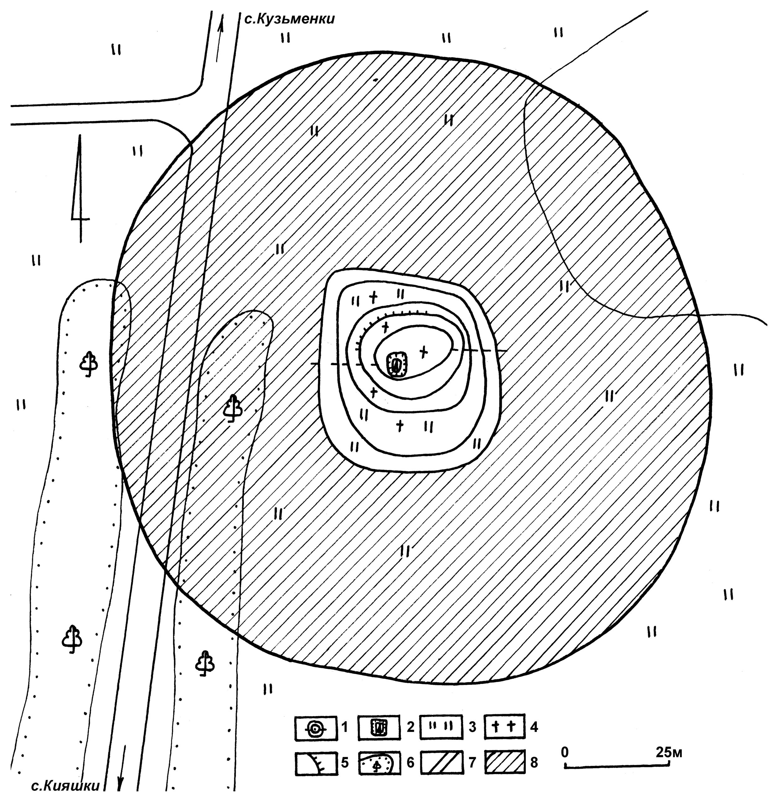
Кузьменки, с. Курган ІІ. План місцерозташування насипу. Умовні позначення: 1 – курган; 2 – дороги з твердим покриттям, насипи; 3 – ґрунтові дороги; 4 – лісосмуги; 5 – лінія електромереж; 6 – населені пункти; 7 – новітні русла річок; 8 – болота; 9 – луки.