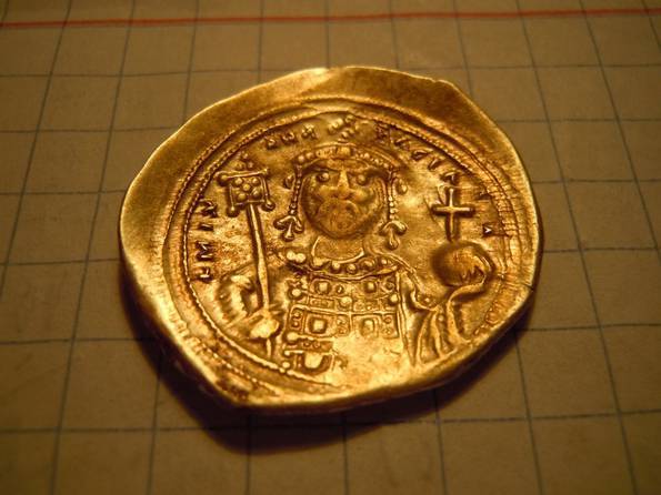
Lukimia village, Lukimia fortified settlement, Lukimia I. The complex of fortified settlement and township of Old Russian times and Cossack era, the remains of the chronicle city of Lukoml, the sotnia town of Lukimia.
Lukimia village, Lukimia fortified settlement, Lukimia I. The complex of fortified settlement and township of Old Russian times and Cossack era, the remains of the chronicle city of Lukoml, the sotnia town of Lukimia.
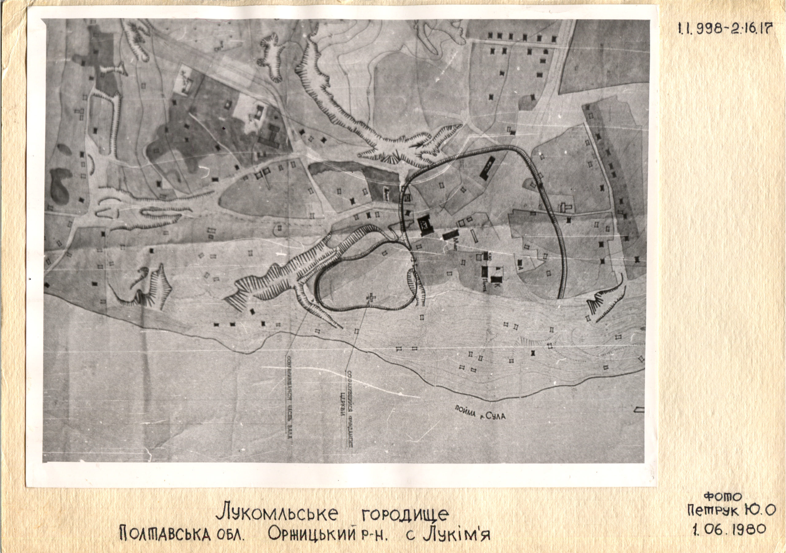
It is located in Lukimia village, Lukimia Village Council, Orzhytsia district, Poltava region, in the eastern part of the village, on the cape and plateau of the root terrace of the right bank of the Sula River, the left feeder of the Dnipro River.
Lukimia fortified settlement was described in the “Geographical description of Kyiv and Kyiv viceroyalty of 1775-1786” and by T. H. Shevchenko. It was surveyed by V.H. Liaskoronskyi (1892), F. B. Kopylov (1945), I.I. Liapushkin (1947), M.P. Kuchera (1979), Yu.Yu. Morhunov (1980), V.V. Sherstiuk (2014).
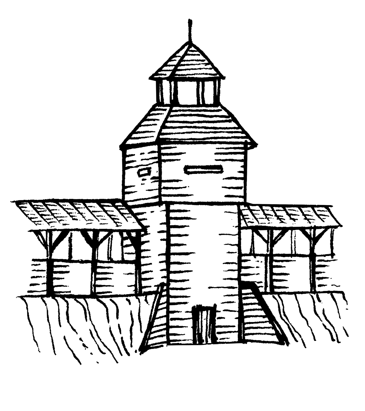
The archaeological complex consists of the remains of a citadel, a fortified post, a township and a burial mound. The fortified part of Lukimia fortified settlement consisted of large and small fortifications.
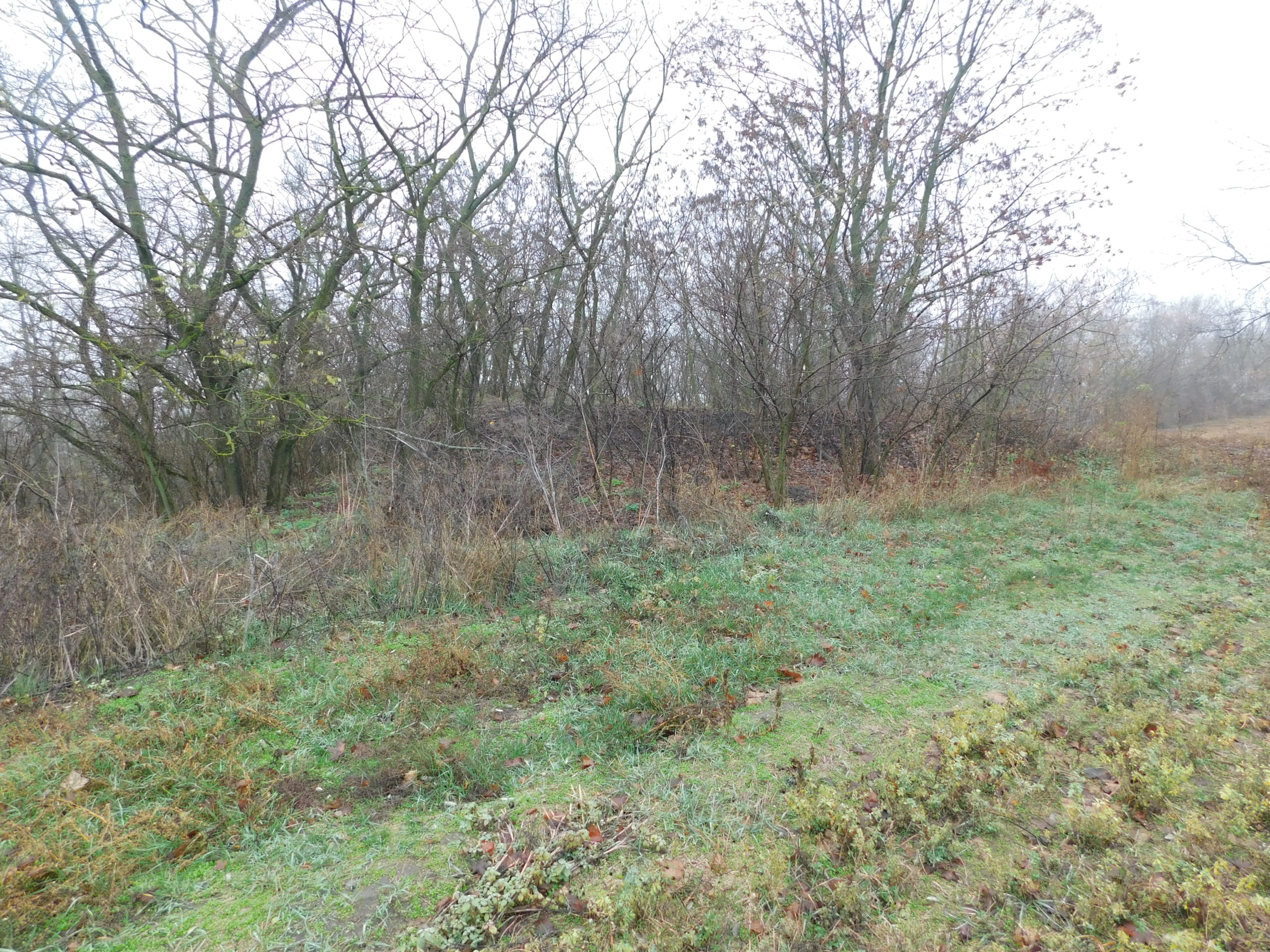
A large fortification is located on the cape, and has an area of about 2.99 hectares. The traces of fortification are relatively well preserved only on the southern side. The breastwork in the southern part of the citadel was preserved to a height of 1.10 m on a fairly short area, then to the south – a moat depth 2.50 m. The small preserved areas of snake-shaped breastworks of insignificant height are traced on the east side of the citadel. There was deep and steep ravine to the east of the entrance separating the fortified post of the citadel. Now it is a soil downgrade, which existed in the late 19th c.. The pot hole of underground passage had previously been discovered at its top.
The area of the small internal fortification is about 1/3 of the total massif (about 0.75 ha). It may be the remains of citadel of the Old Russian period. In addition, the whole complex of the fortified settlement of the end of the 11th – middle of the 13th c. was limited to the fortifications, which in the Cossack time were the castle of the sotnia town.
The fortified post had an area of about 5.15 hectares. Remains of another breastwork have been traced on the territory of the post, closer to the former Castle Gate. Its modern preserved height is insignificant, up to 0.30 m, width 7-15 m.
The township covered an area of about 2.3 hectares.
Lukimia I point is a known complex archaeological site, consisting of the settlement of the Neolithic-Bronze Age, fortified settlement and township of the Old Russian chronicle city Lukoml, the Cossack sotnia town Lukimia, one of the largest chronicle cities of the Old Russian Posullia.
Neolithic Age, Bronze Age settlement, Slavic and Old Russian times, 9th – 13th cc., Cossack era, 17th – 18th cc.
It is located in Lukimia village, Lukimia Village Council, Orzhytsia district, Poltava region, in the eastern part of the village, on the cape and plateau of the root terrace of the right bank of the Sula River, the left feeder of the Dnipro River.
Lukimia fortified settlement was described in the “Geographical description of Kyiv and Kyiv viceroyalty of 1775-1786” and by T. H. Shevchenko. It was surveyed by V.H. Liaskoronskyi (1892), F. B. Kopylov (1945), I.I. Liapushkin (1947), M.P. Kuchera (1979), Yu.Yu. Morhunov (1980), V.V. Sherstiuk (2014).
The archaeological complex consists of the remains of a citadel, a fortified post, a township and a burial mound. The fortified part of Lukimia fortified settlement consisted of large and small fortifications.
A large fortification is located on the cape, and has an area of about 2.99 hectares. The traces of fortification are relatively well preserved only on the southern side. The breastwork in the southern part of the citadel was preserved to a height of 1.10 m on a fairly short area, then to the south – a moat depth 2.50 m. The small preserved areas of snake-shaped breastworks of insignificant height are traced on the east side of the citadel. There was deep and steep ravine to the east of the entrance separating the fortified post of the citadel. Now it is a soil downgrade, which existed in the late 19th c.. The pot hole of underground passage had previously been discovered at its top.
The area of the small internal fortification is about 1/3 of the total massif (about 0.75 ha). It may be the remains of citadel of the Old Russian period. In addition, the whole complex of the fortified settlement of the end of the 11th – middle of the 13th c. was limited to the fortifications, which in the Cossack time were the castle of the sotnia town.
The fortified post had an area of about 5.15 hectares. Remains of another breastwork have been traced on the territory of the post, closer to the former Castle Gate. Its modern preserved height is insignificant, up to 0.30 m, width 7-15 m.
The township covered an area of about 2.3 hectares.
Lukimia I point is a known complex archaeological site, consisting of the settlement of the Neolithic-Bronze Age, fortified settlement and township of the Old Russian chronicle city Lukoml, the Cossack sotnia town Lukimia, one of the largest chronicle cities of the Old Russian Posullia.
Neolithic Age, Bronze Age settlement, Slavic and Old Russian times, 9th – 13th cc., Cossack era, 17th – 18th cc.
Read moreПам’яткоохоронна інформація
Monument protection information
Пам’ятка археології місцевого значення.
Наказ Міністерства культури, молоді та спорту України № 1062 від 25.02.2020 р.
охоронний номер 2679-Пл.
vhid-1.pngПам’ятка археології місцевого значення.
Наказ Міністерства культури, молоді та спорту України № 1062 від 25.02.2020 р.
охоронний номер 2679-Пл.
vhid-1.pngФотогалерея
Gallery

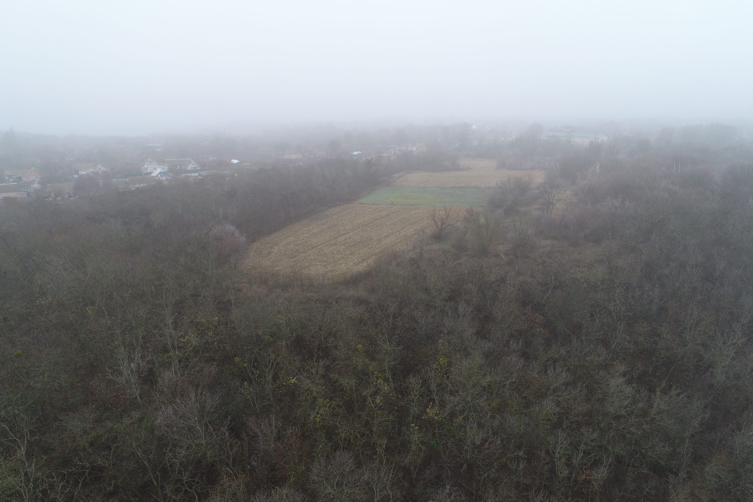
Загальний вигляд на давньоруське городище в с. Лукім'я