It is located within the boundaries of Stasi village, Stasi Village Council, Dykanka district, Poltava region, in the north-eastern part and on the edge of the village, in Verhuzivka natural landmark (Valy).
“Stasi fortified settlement” was first described by V.H. Liaskoronskyi, early 20th c.. It was surveyed by I.I. Liapushkin in 1940, H.T. Kovpanenko in 1953, O.B. Suprunenko, I.M. Kulatova and A.V. Heiko in 1999, O.B. Suprunenko and V.V. Sherstiuk in 2004, 2010, 2012.
The “Stasi fortified settlement” complex consists of a fortified settlement, a suburb, and four townships.
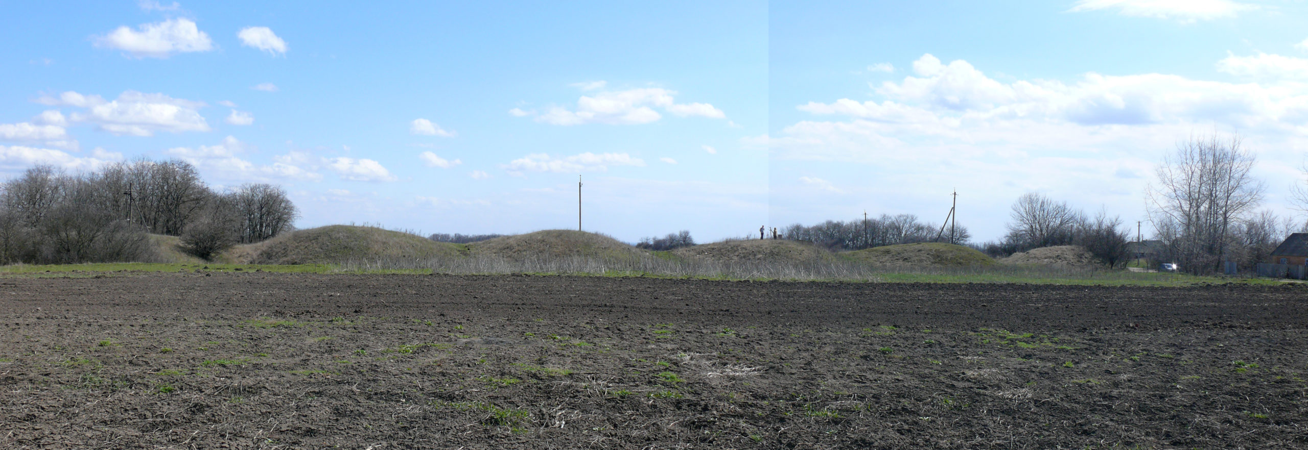
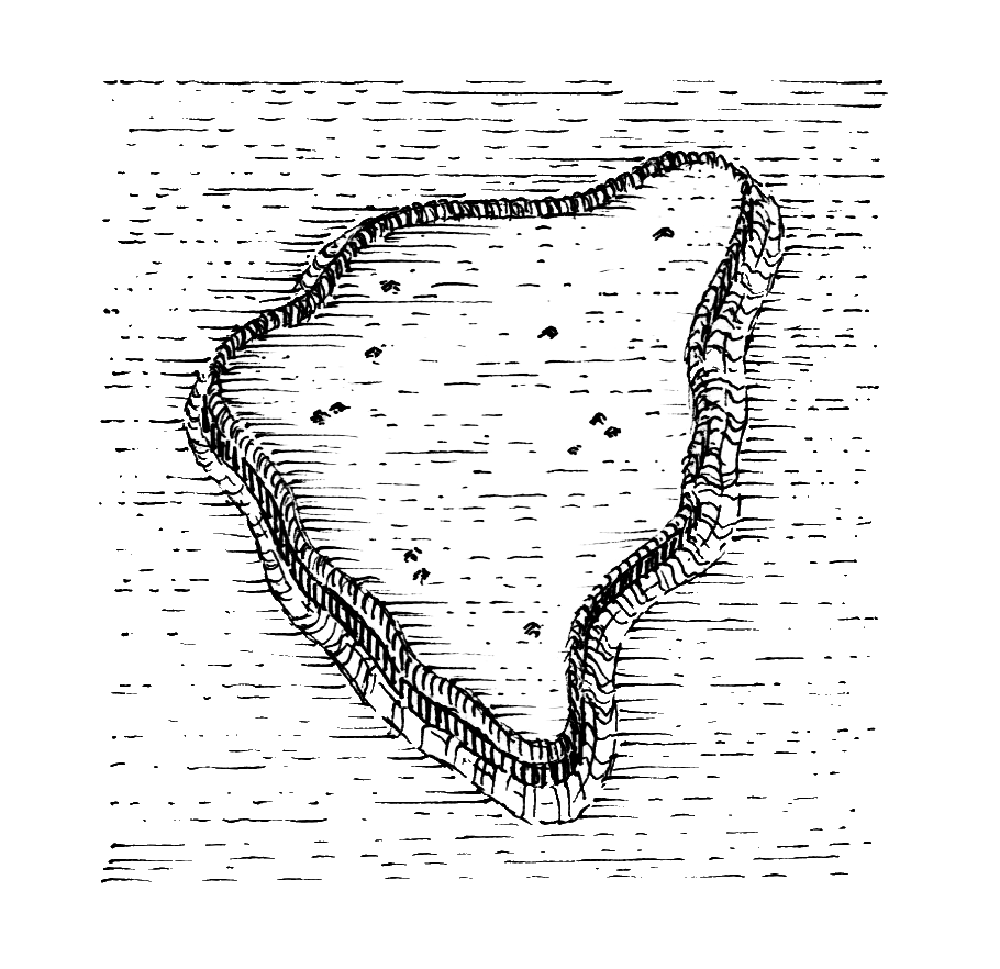
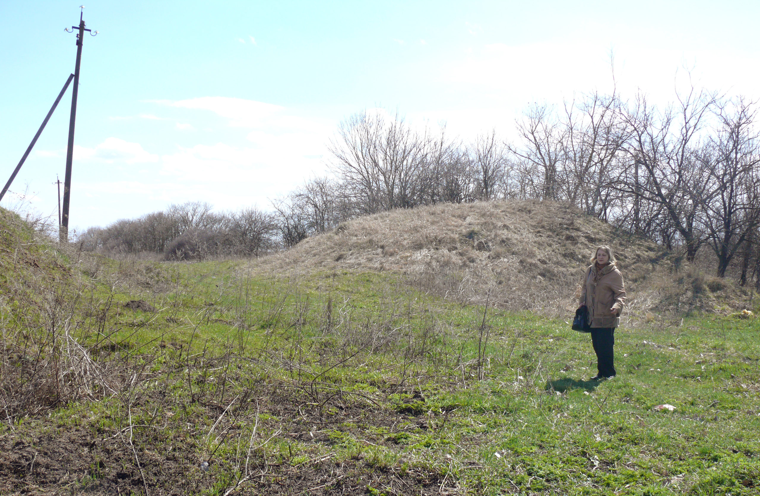
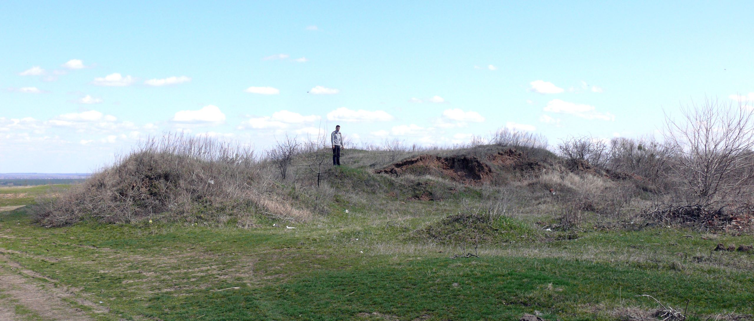
The fortified settlement is located on the north-eastern edge of the village, in Verhuzivka natural landmark (Valy) (north-western part of the archaeological complex) and occupies the foundation of an elongated cape on the high right bank of the Vorskla River. Today it is the best preserved north-eastern part of the fortifications. The breastworks of fortified settlement are 3.20-4.30 m high, and the graff is 6.50-9.0 m wide, in some places up to 12 m. The entrance is located close to the south-western part of the fortified settlement.
The fortified settlement area is 33.40 hectares.
The suburb is adjacent to the fortification from the south-east. Previously, it was also fortified, as evidenced by the breastwork remains, today the height is 0.30-0.60 m, width – 1.50-2.0 m.
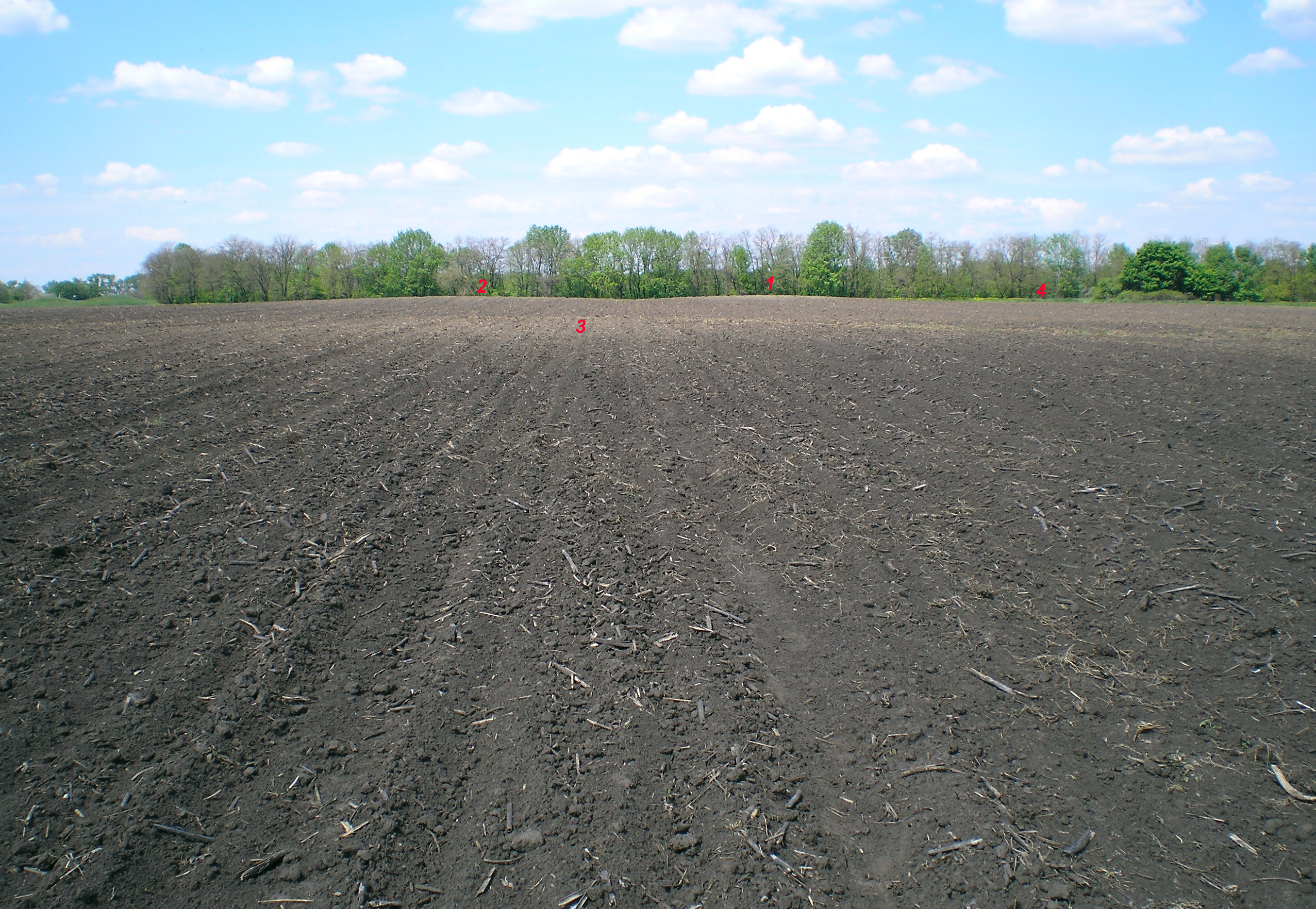
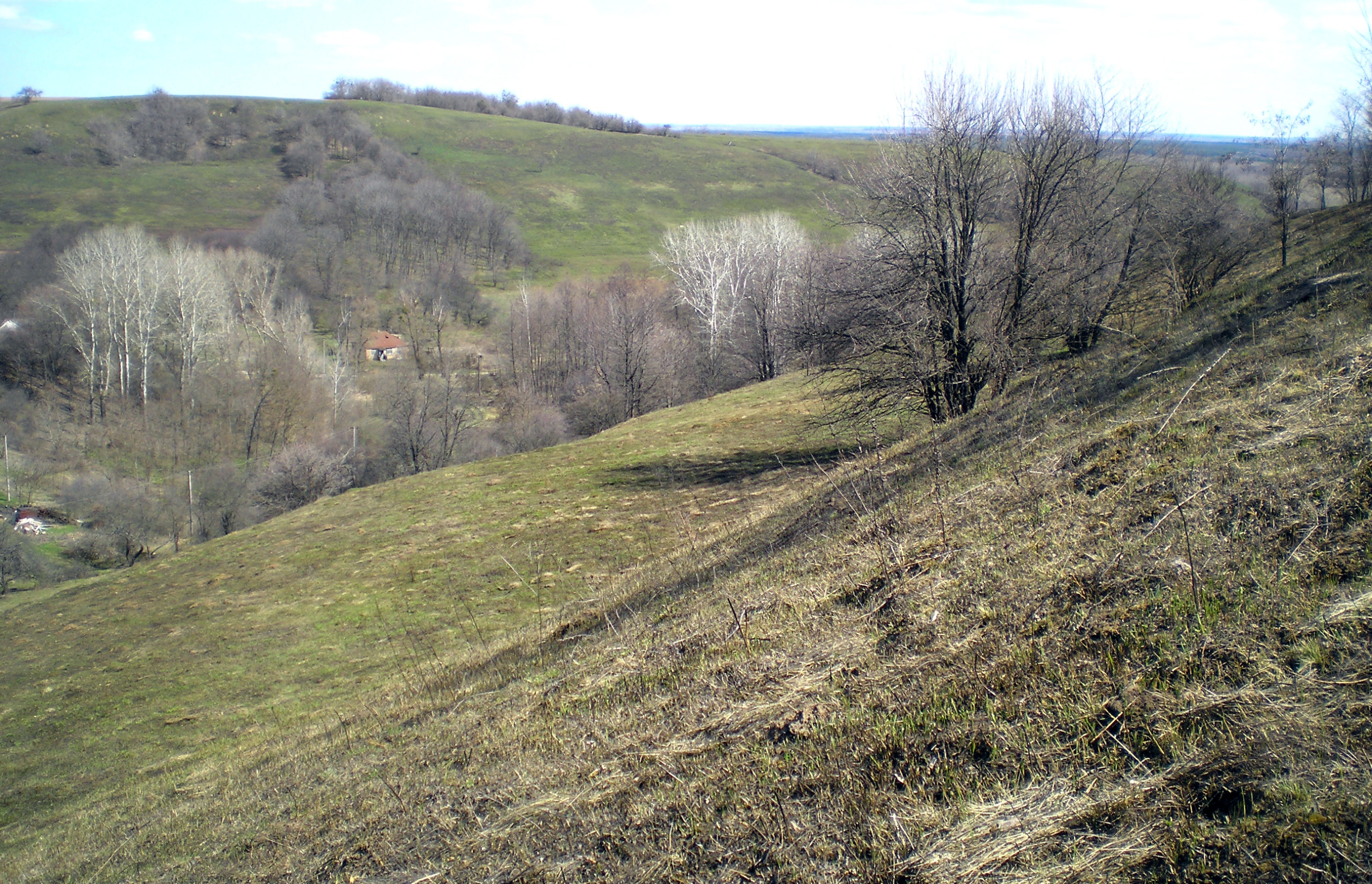
The townships are located to the east of the fortified settlement site, occupying a cape-shaped spur with downhill and steep slopes. Almost the entire territory of the townships has been ploughed, only the edges of the slopes and the area inside the banks remain covered with sward. The settlement area is 11.25 hectares.
During the Cossack era (18th c.), there were isolated farmsteads (khutors) near the estate of representatives of the Cossack officers – Poltava colonels H.S. Hertsyk and V.V. Kochubei in the townships. An interesting fact is the preservation of the house foundations (brick residential building).
The “Stasi fortified settlement” findings are represented mainly by numerous items of the Scythian period (7th – 4th cc. BC). Among some findings are: dagger with an antenna-like knob (6th c. BC), originating from the fortified settlement area. Some findings represent other archaeological cultures – Cherniakhiv culture (4th – early 5th c. AD), the Cossack era and modern times (18th – early 20th cc.).
The “Stasi fortified settlement” is the southernmost known site spreading the defence construction of the local forest-steppe population in the Vorskla basin of the Scythian period of the Early Iron Age. And the remains of the estate location and the stone house are a rare fact of preserving a specific localized area with place of residence of a famous historical figure.
It is located within the boundaries of Stasi village, Stasi Village Council, Dykanka district, Poltava region, in the north-eastern part and on the edge of the village, in Verhuzivka natural landmark (Valy).
“Stasi fortified settlement” was first described by V.H. Liaskoronskyi, early 20th c.. It was surveyed by I.I. Liapushkin in 1940, H.T. Kovpanenko in 1953, O.B. Suprunenko, I.M. Kulatova and A.V. Heiko in 1999, O.B. Suprunenko and V.V. Sherstiuk in 2004, 2010, 2012.
The “Stasi fortified settlement” complex consists of a fortified settlement, a suburb, and four townships.
The fortified settlement is located on the north-eastern edge of the village, in Verhuzivka natural landmark (Valy) (north-western part of the archaeological complex) and occupies the foundation of an elongated cape on the high right bank of the Vorskla River. Today it is the best preserved north-eastern part of the fortifications. The breastworks of fortified settlement are 3.20-4.30 m high, and the graff is 6.50-9.0 m wide, in some places up to 12 m. The entrance is located close to the south-western part of the fortified settlement.
The fortified settlement area is 33.40 hectares.
The suburb is adjacent to the fortification from the south-east. Previously, it was also fortified, as evidenced by the breastwork remains, today the height is 0.30-0.60 m, width – 1.50-2.0 m.
The townships are located to the east of the fortified settlement site, occupying a cape-shaped spur with downhill and steep slopes. Almost the entire territory of the townships has been ploughed, only the edges of the slopes and the area inside the banks remain covered with sward. The settlement area is 11.25 hectares.
During the Cossack era (18th c.), there were isolated farmsteads (khutors) near the estate of representatives of the Cossack officers – Poltava colonels H.S. Hertsyk and V.V. Kochubei in the townships. An interesting fact is the preservation of the house foundations (brick residential building).
The “Stasi fortified settlement” findings are represented mainly by numerous items of the Scythian period (7th – 4th cc. BC). Among some findings are: dagger with an antenna-like knob (6th c. BC), originating from the fortified settlement area. Some findings represent other archaeological cultures – Cherniakhiv culture (4th – early 5th c. AD), the Cossack era and modern times (18th – early 20th cc.).
The “Stasi fortified settlement” is the southernmost known site spreading the defence construction of the local forest-steppe population in the Vorskla basin of the Scythian period of the Early Iron Age. And the remains of the estate location and the stone house are a rare fact of preserving a specific localized area with place of residence of a famous historical figure.
Пам’яткоохоронна інформація
Monument protection information
Пам’ятка археології місцевого значення.
Наказ Міністерства культури України № 228 від 27.03.2013 р.
охоронний номер 4694-Пл.
stasi-i-passport-1.pdfПам’ятка археології місцевого значення.
Наказ Міністерства культури України № 228 від 27.03.2013 р.
охоронний номер 4694-Пл.
stasi-i-passport-1.pdfНаукові публікації
Scientific publications

Кулатова І., Супруненко О., Шерстюк В. Археологічний комплекс Стасі І, ур. Вергузівка (Вали) // Звід пам’яток історії та культури України: Полтавська область. Диканський район [Текст] = Register of Monuments of History and Culture of Ukraine: Poltava Region. Dikanka district/ [упорядн., наук. ред. В. О. Мокляк]; автори статей: В. А. Андрієць, В. М. Бака, Т. А. Бобровський та ін. — Полтава: ТОВ «АСМІ», 2011. – С. 236-247
dykanskyj-zvod-stasi-i-miscz-pam.pdfКулатова І., Супруненко О., Шерстюк В. Археологічний комплекс Стасі І, ур. Вергузівка (Вали) // Звід пам’яток історії та культури України: Полтавська область. Диканський район [Текст] = Register of Monuments of History and Culture of Ukraine: Poltava Region. Dikanka district/ [упорядн., наук. ред. В. О. Мокляк]; автори статей: В. А. Андрієць, В. М. Бака, Т. А. Бобровський та ін. — Полтава: ТОВ «АСМІ», 2011. – С. 236-247
dykanskyj-zvod-stasi-i-miscz-pam.pdfФотогалерея
Gallery
Стасі, с. Городище та селище. Центральна частина майданчика городища із зольниками. Фото 2011 р.
Стасі, с. Городище та селище. Загальний вигляд головної фортифікаційної лінії городища. Фото 2011 р.
Стасі, с. Городище та селище. Ділянка головної фортифікаційної лінії (північно-західна частина). Фото 2011 р.
Стасі, с. Городище та селище. Рештки руйнувань поверхні городища цегельним заводом сер. ХХ ст. Фото 2011 р.
Стасі, с. Городище та селище. Ескарпи та їх основа у північній частині городища. Фото 2011 р.

Стасі, с. Городище та селище. Вал та рів допоміжної фортифікаційної споруди у східній частині городища (зверху). Фото 2011 р.
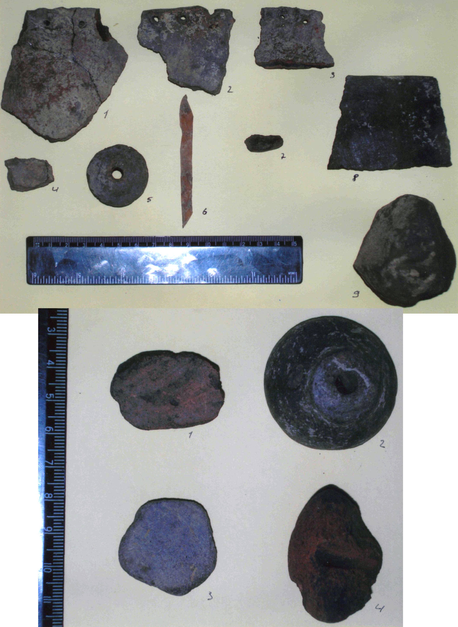
Стасі, с. Городище та селище. Індивідуальні знахідки, розвідка 2004 р. (кераміка, залізо). Фото 2004 р.
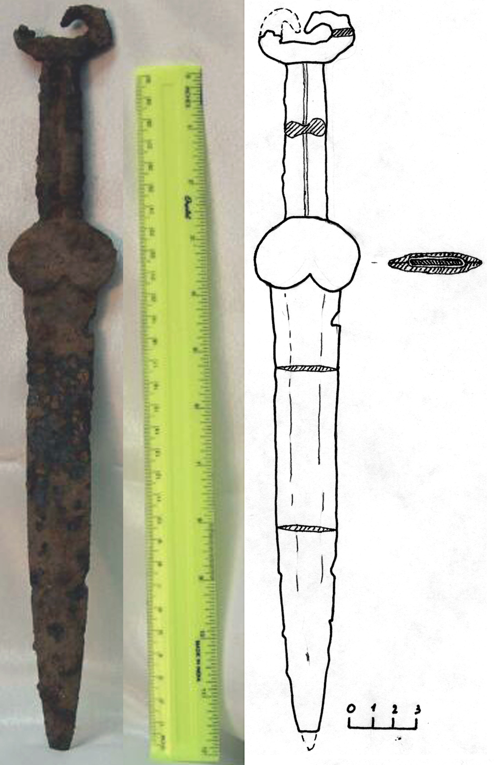
Стасі, с. Городище та селище. Меч (залізо). Фото 2005 р.